You are here: Home > Network List > IW - Intermountain West Stations List
> Station MOOW Moose Ponds, Wyoming, USA > Earthquake Result Viewer
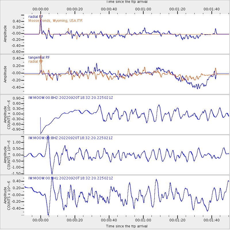
MOOW Moose Ponds, Wyoming, USA - Earthquake Result Viewer
*The percent match for this event was below the threshold and hence no stack was calculated.
| Earthquake location: |
Komandorskiye Ostrova Region |
| Earthquake latitude/longitude: |
55.5/166.3 |
| Earthquake time(UTC): |
2022/09/20 (263) 18:23:42 GMT |
| Earthquake Depth: |
10 km |
| Earthquake Magnitude: |
6.0 mww |
| Earthquake Catalog/Contributor: |
NEIC PDE/us |
|
| Network: |
IW Intermountain West |
| Station: |
MOOW Moose Ponds, Wyoming, USA |
| Lat/Lon: |
43.75 N/110.74 W |
| Elevation: |
2128 m |
|
| Distance: |
51.9 deg |
| Az: |
66.131 deg |
| Baz: |
314.159 deg |
| Ray Param: |
$rayparam |
*The percent match for this event was below the threshold and hence was not used in the summary stack. |
|
| Radial Match: |
53.302753 % |
| Radial Bump: |
400 |
| Transverse Match: |
35.34784 % |
| Transverse Bump: |
400 |
| SOD ConfigId: |
28764291 |
| Insert Time: |
2022-10-04 18:40:39.376 +0000 |
| GWidth: |
2.5 |
| Max Bumps: |
400 |
| Tol: |
0.001 |
|
Signal To Noise
| Channel | StoN | STA | LTA |
| IW:MOOW:00:BHZ:20220920T18:32:20.225021Z | 10.496359 | 6.2878627E-7 | 5.990518E-8 |
| IW:MOOW:00:BH1:20220920T18:32:20.225021Z | 2.3084953 | 2.9374752E-7 | 1.2724631E-7 |
| IW:MOOW:00:BH2:20220920T18:32:20.225021Z | 1.0109895 | 3.834085E-7 | 3.7924082E-7 |
| Arrivals |
| Ps | |
| PpPs | |
| PsPs/PpSs | |


