You are here: Home > Network List > GS - US Geological Survey Networks Stations List
> Station KAN13 Rinehart Farm > Earthquake Result Viewer
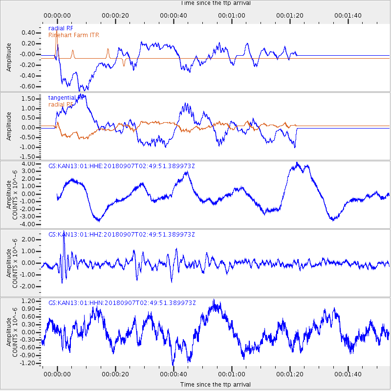
KAN13 Rinehart Farm - Earthquake Result Viewer
*The percent match for this event was below the threshold and hence no stack was calculated.
| Earthquake location: |
Chile-Argentina Border Region |
| Earthquake latitude/longitude: |
-28.9/-70.0 |
| Earthquake time(UTC): |
2018/09/07 (250) 02:39:17 GMT |
| Earthquake Depth: |
92 km |
| Earthquake Magnitude: |
5.8 Mww |
| Earthquake Catalog/Contributor: |
NEIC PDE/us |
|
| Network: |
GS US Geological Survey Networks |
| Station: |
KAN13 Rinehart Farm |
| Lat/Lon: |
37.01 N/97.48 W |
| Elevation: |
340 m |
|
| Distance: |
70.5 deg |
| Az: |
336.891 deg |
| Baz: |
154.534 deg |
| Ray Param: |
$rayparam |
*The percent match for this event was below the threshold and hence was not used in the summary stack. |
|
| Radial Match: |
49.82824 % |
| Radial Bump: |
400 |
| Transverse Match: |
39.492023 % |
| Transverse Bump: |
400 |
| SOD ConfigId: |
2825771 |
| Insert Time: |
2018-09-21 02:41:50.840 +0000 |
| GWidth: |
2.5 |
| Max Bumps: |
400 |
| Tol: |
0.001 |
|
Signal To Noise
| Channel | StoN | STA | LTA |
| GS:KAN13:01:HHZ:20180907T02:49:51.389973Z | 4.50247 | 9.1796767E-7 | 2.038809E-7 |
| GS:KAN13:01:HHN:20180907T02:49:51.389973Z | 0.6714161 | 3.0728094E-7 | 4.5766097E-7 |
| GS:KAN13:01:HHE:20180907T02:49:51.389973Z | 0.60090315 | 9.763033E-7 | 1.6247267E-6 |
| Arrivals |
| Ps | |
| PpPs | |
| PsPs/PpSs | |


