You are here: Home > Network List > UU - University of Utah Regional Network Stations List
> Station FORU South Mineral Mountains, UT, USA > Earthquake Result Viewer
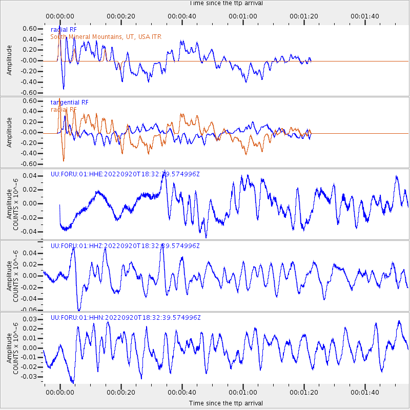
FORU South Mineral Mountains, UT, USA - Earthquake Result Viewer
*The percent match for this event was below the threshold and hence no stack was calculated.
| Earthquake location: |
Komandorskiye Ostrova Region |
| Earthquake latitude/longitude: |
55.5/166.3 |
| Earthquake time(UTC): |
2022/09/20 (263) 18:23:42 GMT |
| Earthquake Depth: |
10 km |
| Earthquake Magnitude: |
6.0 mww |
| Earthquake Catalog/Contributor: |
NEIC PDE/us |
|
| Network: |
UU University of Utah Regional Network |
| Station: |
FORU South Mineral Mountains, UT, USA |
| Lat/Lon: |
38.46 N/112.86 W |
| Elevation: |
1840 m |
|
| Distance: |
54.5 deg |
| Az: |
72.197 deg |
| Baz: |
316.411 deg |
| Ray Param: |
$rayparam |
*The percent match for this event was below the threshold and hence was not used in the summary stack. |
|
| Radial Match: |
56.763546 % |
| Radial Bump: |
400 |
| Transverse Match: |
56.857376 % |
| Transverse Bump: |
400 |
| SOD ConfigId: |
28764291 |
| Insert Time: |
2022-10-04 18:58:33.530 +0000 |
| GWidth: |
2.5 |
| Max Bumps: |
400 |
| Tol: |
0.001 |
|
Signal To Noise
| Channel | StoN | STA | LTA |
| UU:FORU:01:HHZ:20220920T18:32:39.574996Z | 5.8988643 | 2.1112456E-8 | 3.5790715E-9 |
| UU:FORU:01:HHN:20220920T18:32:39.574996Z | 5.406785 | 2.5023782E-8 | 4.6282183E-9 |
| UU:FORU:01:HHE:20220920T18:32:39.574996Z | 2.1497319 | 3.1918653E-8 | 1.4847737E-8 |
| Arrivals |
| Ps | |
| PpPs | |
| PsPs/PpSs | |


