You are here: Home > Network List > US - United States National Seismic Network Stations List
> Station MSO Missoula, Montana, USA > Earthquake Result Viewer
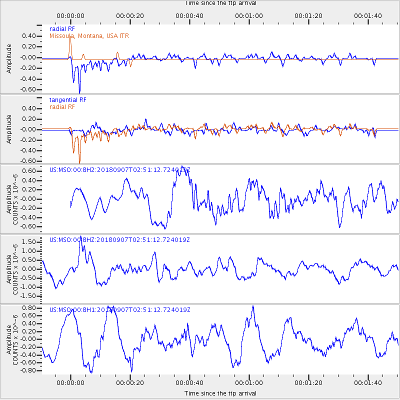
MSO Missoula, Montana, USA - Earthquake Result Viewer
*The percent match for this event was below the threshold and hence no stack was calculated.
| Earthquake location: |
Chile-Argentina Border Region |
| Earthquake latitude/longitude: |
-28.9/-70.0 |
| Earthquake time(UTC): |
2018/09/07 (250) 02:39:17 GMT |
| Earthquake Depth: |
92 km |
| Earthquake Magnitude: |
5.8 Mww |
| Earthquake Catalog/Contributor: |
NEIC PDE/us |
|
| Network: |
US United States National Seismic Network |
| Station: |
MSO Missoula, Montana, USA |
| Lat/Lon: |
46.83 N/113.94 W |
| Elevation: |
1264 m |
|
| Distance: |
85.2 deg |
| Az: |
331.41 deg |
| Baz: |
142.327 deg |
| Ray Param: |
$rayparam |
*The percent match for this event was below the threshold and hence was not used in the summary stack. |
|
| Radial Match: |
77.696434 % |
| Radial Bump: |
400 |
| Transverse Match: |
73.88313 % |
| Transverse Bump: |
400 |
| SOD ConfigId: |
2825771 |
| Insert Time: |
2018-09-21 02:46:07.062 +0000 |
| GWidth: |
2.5 |
| Max Bumps: |
400 |
| Tol: |
0.001 |
|
Signal To Noise
| Channel | StoN | STA | LTA |
| US:MSO:00:BHZ:20180907T02:51:12.724019Z | 2.8724315 | 8.363239E-7 | 2.911554E-7 |
| US:MSO:00:BH1:20180907T02:51:12.724019Z | 2.3382933 | 5.866478E-7 | 2.5088715E-7 |
| US:MSO:00:BH2:20180907T02:51:12.724019Z | 2.4517205 | 5.0083185E-7 | 2.0427771E-7 |
| Arrivals |
| Ps | |
| PpPs | |
| PsPs/PpSs | |


