You are here: Home > Network List > US - United States National Seismic Network Stations List
> Station HAWA Hanford, Washington, USA > Earthquake Result Viewer
HAWA Hanford, Washington, USA - Earthquake Result Viewer

| Earthquake location: |
Michoacan, Mexico |
| Earthquake latitude/longitude: |
18.4/-102.9 |
| Earthquake time(UTC): |
2022/09/22 (265) 06:16:11 GMT |
| Earthquake Depth: |
61 km |
| Earthquake Magnitude: |
6.8 mww |
| Earthquake Catalog/Contributor: |
NEIC PDE/at |
|
| Network: |
US United States National Seismic Network |
| Station: |
HAWA Hanford, Washington, USA |
| Lat/Lon: |
46.39 N/119.53 W |
| Elevation: |
364 m |
|
| Distance: |
31.1 deg |
| Az: |
337.456 deg |
| Baz: |
148.267 deg |
| Ray Param: |
0.079074845 |
| Estimated Moho Depth: |
18.5 km |
| Estimated Crust Vp/Vs: |
2.10 |
| Assumed Crust Vp: |
6.419 km/s |
| Estimated Crust Vs: |
3.06 km/s |
| Estimated Crust Poisson's Ratio: |
0.35 |
|
| Radial Match: |
93.87619 % |
| Radial Bump: |
267 |
| Transverse Match: |
76.39312 % |
| Transverse Bump: |
400 |
| SOD ConfigId: |
28764291 |
| Insert Time: |
2022-10-06 06:36:16.748 +0000 |
| GWidth: |
2.5 |
| Max Bumps: |
400 |
| Tol: |
0.001 |
|
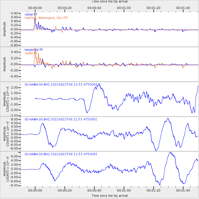
Signal To Noise
| Channel | StoN | STA | LTA |
| US:HAWA:00:BHZ:20220922T06:21:53.475006Z | 21.857685 | 2.4659428E-6 | 1.12818114E-7 |
| US:HAWA:00:BH1:20220922T06:21:53.475006Z | 18.266233 | 1.0449478E-6 | 5.720653E-8 |
| US:HAWA:00:BH2:20220922T06:21:53.475006Z | 10.787114 | 8.645196E-7 | 8.0143735E-8 |
| Arrivals |
| Ps | 3.4 SECOND |
| PpPs | 8.3 SECOND |
| PsPs/PpSs | 12 SECOND |


