MM04 LeRaysville, Pennsylvania - Earthquake Result Viewer
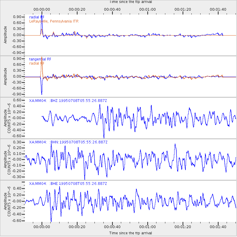
Earthquake location: Off East Coast Of Honshu, Japan
Earthquake latitude/longitude: 39.6/143.4
Earthquake time(UTC): 1995/07/08 (189) 05:42:56 GMT
Earthquake Depth: 40 km
Earthquake Magnitude: 5.7 MB, 5.5 MS, 5.2 UNKNOWN, 6.0 MW
Earthquake Catalog/Contributor: WHDF/NEIC
Network: XA Missouri to Massachusetts Transect
Station: MM04 LeRaysville, Pennsylvania
Lat/Lon: 41.85 N/76.20 W
Elevation: 473 m
Distance: 91.3 deg
Az: 28.414 deg
Baz: 330.54 deg
Ray Param: 0.04160751
Estimated Moho Depth: 36.5 km
Estimated Crust Vp/Vs: 2.10
Assumed Crust Vp: 6.121 km/s
Estimated Crust Vs: 2.918 km/s
Estimated Crust Poisson's Ratio: 0.35
Radial Match: 83.86266 %
Radial Bump: 400
Transverse Match: 83.15506 %
Transverse Bump: 400
SOD ConfigId: 6273
Insert Time: 2010-02-26 17:45:03.479 +0000
GWidth: 2.5
Max Bumps: 400
Tol: 0.001

Signal To Noise

ChannelStoNSTALTA
XA:MM04: :BHN:19950708T05:55:26.887Z1.4064247.22473E-85.1369504E-8
XA:MM04: :BHE:19950708T05:55:26.887Z1.54935051.5974375E-71.0310369E-7
XA:MM04: :BHZ:19950708T05:55:26.887Z2.11203981.805007E-78.546273E-8
Arrivals
Ps6.6 SECOND
PpPs18 SECOND
PsPs/PpSs25 SECOND