You are here: Home > Network List > XA95 - Missouri to Massachusetts Transect Stations List
> Station MM04 LeRaysville, Pennsylvania > Earthquake Result Viewer
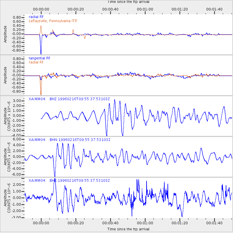
MM04 LeRaysville, Pennsylvania - Earthquake Result Viewer
*The percent match for this event was below the threshold and hence no stack was calculated.
| Earthquake location: |
North Of Ascension Island |
| Earthquake latitude/longitude: |
-1.5/-15.2 |
| Earthquake time(UTC): |
1996/02/16 (047) 09:44:58 GMT |
| Earthquake Depth: |
10 km |
| Earthquake Magnitude: |
6.0 MB, 6.3 MS, 6.5 UNKNOWN, 6.4 MW |
| Earthquake Catalog/Contributor: |
WHDF/NEIC |
|
| Network: |
XA Missouri to Massachusetts Transect |
| Station: |
MM04 LeRaysville, Pennsylvania |
| Lat/Lon: |
41.85 N/76.20 W |
| Elevation: |
473 m |
|
| Distance: |
69.8 deg |
| Az: |
315.898 deg |
| Baz: |
111.376 deg |
| Ray Param: |
$rayparam |
*The percent match for this event was below the threshold and hence was not used in the summary stack. |
|
| Radial Match: |
85.46718 % |
| Radial Bump: |
255 |
| Transverse Match: |
55.884117 % |
| Transverse Bump: |
400 |
| SOD ConfigId: |
4480 |
| Insert Time: |
2010-02-26 17:45:10.528 +0000 |
| GWidth: |
2.5 |
| Max Bumps: |
400 |
| Tol: |
0.001 |
|
Signal To Noise
| Channel | StoN | STA | LTA |
| XA:MM04: :BHN:19960216T09:55:37.53103Z | 0.74390435 | 4.076682E-7 | 5.4801154E-7 |
| XA:MM04: :BHE:19960216T09:55:37.53103Z | 0.5383491 | 2.6328573E-7 | 4.8906134E-7 |
| XA:MM04: :BHZ:19960216T09:55:37.53103Z | 1.8615141 | 9.400813E-7 | 5.05009E-7 |
| Arrivals |
| Ps | |
| PpPs | |
| PsPs/PpSs | |


