You are here: Home > Network List > XA95 - Missouri to Massachusetts Transect Stations List
> Station MM04 LeRaysville, Pennsylvania > Earthquake Result Viewer
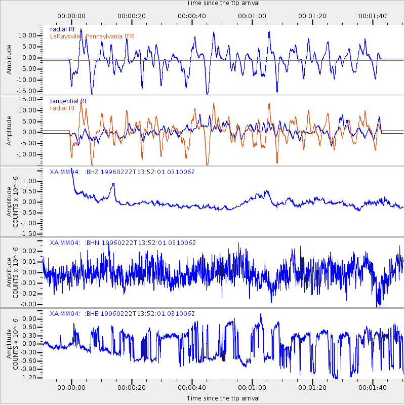
MM04 LeRaysville, Pennsylvania - Earthquake Result Viewer
*The percent match for this event was below the threshold and hence no stack was calculated.
| Earthquake location: |
Near Coast Of Central Chile |
| Earthquake latitude/longitude: |
-33.7/-71.7 |
| Earthquake time(UTC): |
1996/02/22 (053) 13:40:53 GMT |
| Earthquake Depth: |
44 km |
| Earthquake Magnitude: |
5.9 MB, 5.5 MS, 6.0 UNKNOWN, 5.9 MW |
| Earthquake Catalog/Contributor: |
WHDF/NEIC |
|
| Network: |
XA Missouri to Massachusetts Transect |
| Station: |
MM04 LeRaysville, Pennsylvania |
| Lat/Lon: |
41.85 N/76.20 W |
| Elevation: |
473 m |
|
| Distance: |
75.3 deg |
| Az: |
356.532 deg |
| Baz: |
176.129 deg |
| Ray Param: |
$rayparam |
*The percent match for this event was below the threshold and hence was not used in the summary stack. |
|
| Radial Match: |
50.74156 % |
| Radial Bump: |
400 |
| Transverse Match: |
39.96577 % |
| Transverse Bump: |
400 |
| SOD ConfigId: |
4480 |
| Insert Time: |
2010-02-26 17:45:11.353 +0000 |
| GWidth: |
2.5 |
| Max Bumps: |
400 |
| Tol: |
0.001 |
|
Signal To Noise
| Channel | StoN | STA | LTA |
| XA:MM04: :BHN:19960222T13:52:01.031006Z | 0.6411559 | 6.276266E-9 | 9.7889865E-9 |
| XA:MM04: :BHE:19960222T13:52:01.031006Z | 1.500582 | 2.4451325E-7 | 1.6294561E-7 |
| XA:MM04: :BHZ:19960222T13:52:01.031006Z | 1.0437675 | 3.377531E-7 | 3.2359037E-7 |
| Arrivals |
| Ps | |
| PpPs | |
| PsPs/PpSs | |


