You are here: Home > Network List > US - United States National Seismic Network Stations List
> Station ELK Elko, Nevada, USA > Earthquake Result Viewer
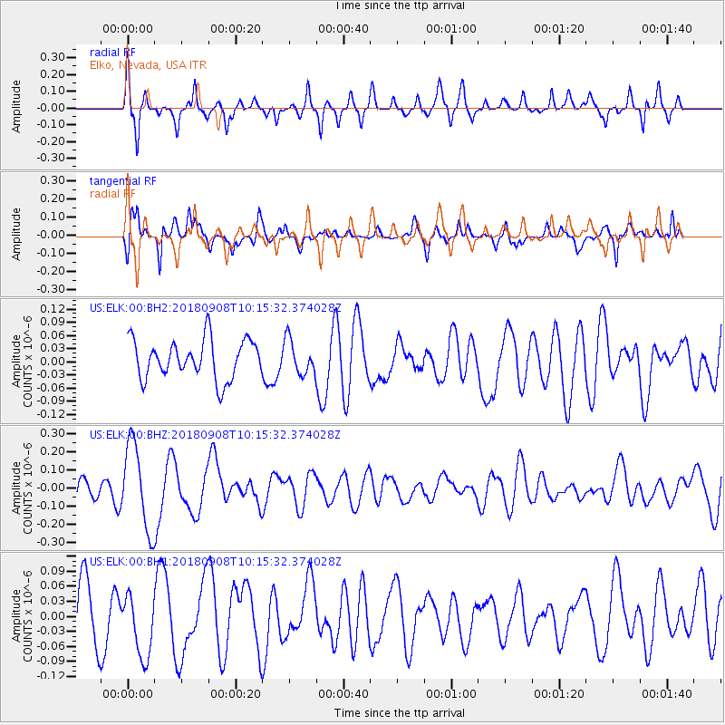
ELK Elko, Nevada, USA - Earthquake Result Viewer
*The percent match for this event was below the threshold and hence no stack was calculated.
| Earthquake location: |
Southeast Of Loyalty Islands |
| Earthquake latitude/longitude: |
-22.2/170.2 |
| Earthquake time(UTC): |
2018/09/08 (251) 10:02:49 GMT |
| Earthquake Depth: |
10 km |
| Earthquake Magnitude: |
5.7 Mww |
| Earthquake Catalog/Contributor: |
NEIC PDE/us |
|
| Network: |
US United States National Seismic Network |
| Station: |
ELK Elko, Nevada, USA |
| Lat/Lon: |
40.74 N/115.24 W |
| Elevation: |
2210 m |
|
| Distance: |
93.3 deg |
| Az: |
47.202 deg |
| Baz: |
243.491 deg |
| Ray Param: |
$rayparam |
*The percent match for this event was below the threshold and hence was not used in the summary stack. |
|
| Radial Match: |
64.23843 % |
| Radial Bump: |
297 |
| Transverse Match: |
60.752846 % |
| Transverse Bump: |
346 |
| SOD ConfigId: |
2825771 |
| Insert Time: |
2018-09-22 10:07:24.706 +0000 |
| GWidth: |
2.5 |
| Max Bumps: |
400 |
| Tol: |
0.001 |
|
Signal To Noise
| Channel | StoN | STA | LTA |
| US:ELK:00:BHZ:20180908T10:15:32.374028Z | 3.5749595 | 2.3884488E-7 | 6.6810514E-8 |
| US:ELK:00:BH1:20180908T10:15:32.374028Z | 1.0731261 | 6.3870154E-8 | 5.9517845E-8 |
| US:ELK:00:BH2:20180908T10:15:32.374028Z | 0.8870071 | 3.9324526E-8 | 4.4333948E-8 |
| Arrivals |
| Ps | |
| PpPs | |
| PsPs/PpSs | |


