You are here: Home > Network List > XA95 - Missouri to Massachusetts Transect Stations List
> Station MM04 LeRaysville, Pennsylvania > Earthquake Result Viewer
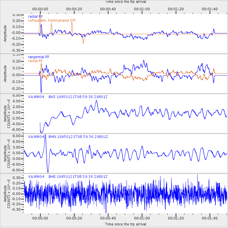
MM04 LeRaysville, Pennsylvania - Earthquake Result Viewer
*The percent match for this event was below the threshold and hence no stack was calculated.
| Earthquake location: |
Kuril Islands |
| Earthquake latitude/longitude: |
43.3/146.7 |
| Earthquake time(UTC): |
1995/01/21 (021) 08:47:29 GMT |
| Earthquake Depth: |
63 km |
| Earthquake Magnitude: |
6.5 MB, 6.6 UNKNOWN, 6.4 MW |
| Earthquake Catalog/Contributor: |
WHDF/NEIC |
|
| Network: |
XA Missouri to Massachusetts Transect |
| Station: |
MM04 LeRaysville, Pennsylvania |
| Lat/Lon: |
41.85 N/76.20 W |
| Elevation: |
473 m |
|
| Distance: |
86.8 deg |
| Az: |
30.629 deg |
| Baz: |
330.159 deg |
| Ray Param: |
$rayparam |
*The percent match for this event was below the threshold and hence was not used in the summary stack. |
|
| Radial Match: |
32.2712 % |
| Radial Bump: |
400 |
| Transverse Match: |
31.859732 % |
| Transverse Bump: |
400 |
| SOD ConfigId: |
4480 |
| Insert Time: |
2010-02-26 17:45:18.032 +0000 |
| GWidth: |
2.5 |
| Max Bumps: |
400 |
| Tol: |
0.001 |
|
Signal To Noise
| Channel | StoN | STA | LTA |
| XA:MM04: :BHN:19950121T08:59:36.29801Z | 3.8038476 | 5.124493E-6 | 1.3471868E-6 |
| XA:MM04: :BHE:19950121T08:59:36.29801Z | 1.0030326 | 1.11108506E-7 | 1.1077257E-7 |
| XA:MM04: :BHZ:19950121T08:59:36.29801Z | 2.5537715 | 4.6150753E-6 | 1.8071605E-6 |
| Arrivals |
| Ps | |
| PpPs | |
| PsPs/PpSs | |


