You are here: Home > Network List > US - United States National Seismic Network Stations List
> Station MSO Missoula, Montana, USA > Earthquake Result Viewer
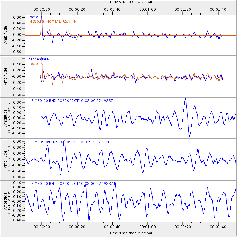
MSO Missoula, Montana, USA - Earthquake Result Viewer
*The percent match for this event was below the threshold and hence no stack was calculated.
| Earthquake location: |
Reykjanes Ridge |
| Earthquake latitude/longitude: |
54.0/-35.2 |
| Earthquake time(UTC): |
2022/09/26 (269) 09:59:56 GMT |
| Earthquake Depth: |
10 km |
| Earthquake Magnitude: |
5.7 mww |
| Earthquake Catalog/Contributor: |
NEIC PDE/us |
|
| Network: |
US United States National Seismic Network |
| Station: |
MSO Missoula, Montana, USA |
| Lat/Lon: |
46.83 N/113.94 W |
| Elevation: |
1264 m |
|
| Distance: |
48.2 deg |
| Az: |
295.462 deg |
| Baz: |
50.916 deg |
| Ray Param: |
$rayparam |
*The percent match for this event was below the threshold and hence was not used in the summary stack. |
|
| Radial Match: |
72.40636 % |
| Radial Bump: |
400 |
| Transverse Match: |
51.234055 % |
| Transverse Bump: |
386 |
| SOD ConfigId: |
28764291 |
| Insert Time: |
2022-10-10 10:31:00.800 +0000 |
| GWidth: |
2.5 |
| Max Bumps: |
400 |
| Tol: |
0.001 |
|
Signal To Noise
| Channel | StoN | STA | LTA |
| US:MSO:00:BHZ:20220926T10:08:06.224988Z | 2.5626156 | 3.4812095E-7 | 1.3584594E-7 |
| US:MSO:00:BH1:20220926T10:08:06.224988Z | 0.9953035 | 1.4313105E-7 | 1.4380643E-7 |
| US:MSO:00:BH2:20220926T10:08:06.224988Z | 1.9310406 | 2.4927485E-7 | 1.2908833E-7 |
| Arrivals |
| Ps | |
| PpPs | |
| PsPs/PpSs | |


