You are here: Home > Network List > XA95 - Missouri to Massachusetts Transect Stations List
> Station MM04 LeRaysville, Pennsylvania > Earthquake Result Viewer
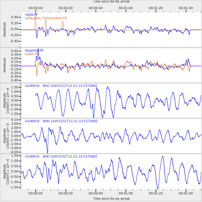
MM04 LeRaysville, Pennsylvania - Earthquake Result Viewer
*The percent match for this event was below the threshold and hence no stack was calculated.
| Earthquake location: |
Northern Mid-Atlantic Ridge |
| Earthquake latitude/longitude: |
10.8/-42.6 |
| Earthquake time(UTC): |
1995/02/02 (033) 12:53:53 GMT |
| Earthquake Depth: |
10 km |
| Earthquake Magnitude: |
5.6 MB, 5.4 MS, 5.8 UNKNOWN |
| Earthquake Catalog/Contributor: |
WHDF/NEIC |
|
| Network: |
XA Missouri to Massachusetts Transect |
| Station: |
MM04 LeRaysville, Pennsylvania |
| Lat/Lon: |
41.85 N/76.20 W |
| Elevation: |
473 m |
|
| Distance: |
42.7 deg |
| Az: |
322.424 deg |
| Baz: |
126.668 deg |
| Ray Param: |
$rayparam |
*The percent match for this event was below the threshold and hence was not used in the summary stack. |
|
| Radial Match: |
51.037533 % |
| Radial Bump: |
400 |
| Transverse Match: |
72.43145 % |
| Transverse Bump: |
400 |
| SOD ConfigId: |
4480 |
| Insert Time: |
2010-02-26 17:45:21.275 +0000 |
| GWidth: |
2.5 |
| Max Bumps: |
400 |
| Tol: |
0.001 |
|
Signal To Noise
| Channel | StoN | STA | LTA |
| XA:MM04: :BHN:19950202T13:01:19.537988Z | 3.5122595 | 1.0428535E-6 | 2.969181E-7 |
| XA:MM04: :BHE:19950202T13:01:19.537988Z | 0.90257716 | 3.701312E-7 | 4.1008263E-7 |
| XA:MM04: :BHZ:19950202T13:01:19.537988Z | 0.60501873 | 5.039228E-7 | 8.3290456E-7 |
| Arrivals |
| Ps | |
| PpPs | |
| PsPs/PpSs | |


