You are here: Home > Network List > IU - Global Seismograph Network (GSN - IRIS/USGS) Stations List
> Station PMG Port Moresby, New Guinea > Earthquake Result Viewer
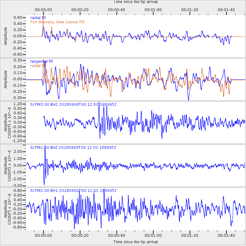
PMG Port Moresby, New Guinea - Earthquake Result Viewer
*The percent match for this event was below the threshold and hence no stack was calculated.
| Earthquake location: |
South Of Fiji Islands |
| Earthquake latitude/longitude: |
-25.0/179.9 |
| Earthquake time(UTC): |
2018/09/09 (252) 00:06:23 GMT |
| Earthquake Depth: |
479 km |
| Earthquake Magnitude: |
5.5 Mww |
| Earthquake Catalog/Contributor: |
NEIC PDE/us |
|
| Network: |
IU Global Seismograph Network (GSN - IRIS/USGS) |
| Station: |
PMG Port Moresby, New Guinea |
| Lat/Lon: |
9.40 S/147.16 E |
| Elevation: |
90 m |
|
| Distance: |
34.8 deg |
| Az: |
290.674 deg |
| Baz: |
120.657 deg |
| Ray Param: |
$rayparam |
*The percent match for this event was below the threshold and hence was not used in the summary stack. |
|
| Radial Match: |
49.74959 % |
| Radial Bump: |
400 |
| Transverse Match: |
60.99135 % |
| Transverse Bump: |
400 |
| SOD ConfigId: |
2825771 |
| Insert Time: |
2018-09-23 00:12:55.497 +0000 |
| GWidth: |
2.5 |
| Max Bumps: |
400 |
| Tol: |
0.001 |
|
Signal To Noise
| Channel | StoN | STA | LTA |
| IU:PMG:00:BHZ:20180909T00:12:03.168995Z | 5.032627 | 1.0102634E-6 | 2.0074276E-7 |
| IU:PMG:00:BH1:20180909T00:12:03.168995Z | 1.8023599 | 3.4991086E-7 | 1.9414038E-7 |
| IU:PMG:00:BH2:20180909T00:12:03.168995Z | 3.2768269 | 5.7593684E-7 | 1.7576053E-7 |
| Arrivals |
| Ps | |
| PpPs | |
| PsPs/PpSs | |


