You are here: Home > Network List > US - United States National Seismic Network Stations List
> Station MSO Missoula, Montana, USA > Earthquake Result Viewer
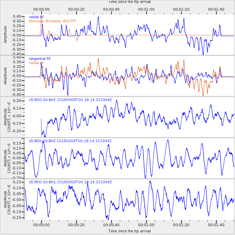
MSO Missoula, Montana, USA - Earthquake Result Viewer
*The percent match for this event was below the threshold and hence no stack was calculated.
| Earthquake location: |
South Of Fiji Islands |
| Earthquake latitude/longitude: |
-25.0/179.9 |
| Earthquake time(UTC): |
2018/09/09 (252) 00:06:23 GMT |
| Earthquake Depth: |
479 km |
| Earthquake Magnitude: |
5.5 Mww |
| Earthquake Catalog/Contributor: |
NEIC PDE/us |
|
| Network: |
US United States National Seismic Network |
| Station: |
MSO Missoula, Montana, USA |
| Lat/Lon: |
46.83 N/113.94 W |
| Elevation: |
1264 m |
|
| Distance: |
93.1 deg |
| Az: |
38.956 deg |
| Baz: |
236.176 deg |
| Ray Param: |
$rayparam |
*The percent match for this event was below the threshold and hence was not used in the summary stack. |
|
| Radial Match: |
43.696285 % |
| Radial Bump: |
400 |
| Transverse Match: |
56.783794 % |
| Transverse Bump: |
400 |
| SOD ConfigId: |
2825771 |
| Insert Time: |
2018-09-23 00:14:07.873 +0000 |
| GWidth: |
2.5 |
| Max Bumps: |
400 |
| Tol: |
0.001 |
|
Signal To Noise
| Channel | StoN | STA | LTA |
| US:MSO:00:BHZ:20180909T00:18:14.323994Z | 1.7384733 | 9.274142E-8 | 5.3346476E-8 |
| US:MSO:00:BH1:20180909T00:18:14.323994Z | 1.4999967 | 9.056158E-8 | 6.037452E-8 |
| US:MSO:00:BH2:20180909T00:18:14.323994Z | 1.1067048 | 1.02620476E-7 | 9.2726154E-8 |
| Arrivals |
| Ps | |
| PpPs | |
| PsPs/PpSs | |


