You are here: Home > Network List > XA95 - Missouri to Massachusetts Transect Stations List
> Station MM04 LeRaysville, Pennsylvania > Earthquake Result Viewer
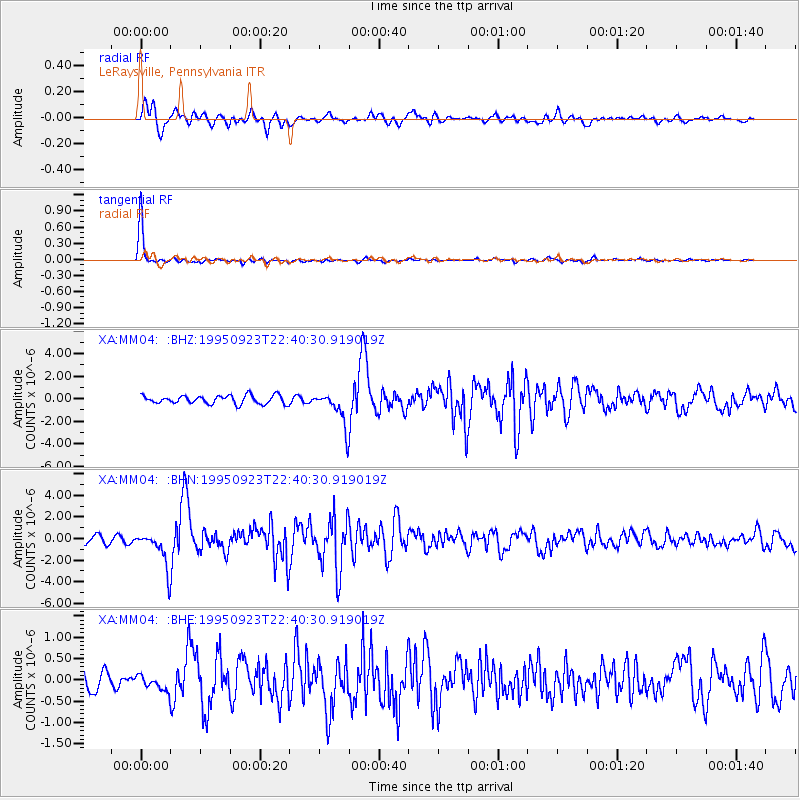
MM04 LeRaysville, Pennsylvania - Earthquake Result Viewer
*The percent match for this event was below the threshold and hence no stack was calculated.
| Earthquake location: |
Near Coast Of Peru |
| Earthquake latitude/longitude: |
-10.5/-78.7 |
| Earthquake time(UTC): |
1995/09/23 (266) 22:31:58 GMT |
| Earthquake Depth: |
73 km |
| Earthquake Magnitude: |
5.9 MB, 6.5 UNKNOWN, 6.4 MW |
| Earthquake Catalog/Contributor: |
WHDF/NEIC |
|
| Network: |
XA Missouri to Massachusetts Transect |
| Station: |
MM04 LeRaysville, Pennsylvania |
| Lat/Lon: |
41.85 N/76.20 W |
| Elevation: |
473 m |
|
| Distance: |
52.2 deg |
| Az: |
2.364 deg |
| Baz: |
183.112 deg |
| Ray Param: |
$rayparam |
*The percent match for this event was below the threshold and hence was not used in the summary stack. |
|
| Radial Match: |
83.49151 % |
| Radial Bump: |
400 |
| Transverse Match: |
97.38594 % |
| Transverse Bump: |
160 |
| SOD ConfigId: |
4480 |
| Insert Time: |
2010-02-26 17:45:32.009 +0000 |
| GWidth: |
2.5 |
| Max Bumps: |
400 |
| Tol: |
0.001 |
|
Signal To Noise
| Channel | StoN | STA | LTA |
| XA:MM04: :BHN:19950923T22:40:30.919019Z | 3.97133 | 1.6242857E-6 | 4.0900298E-7 |
| XA:MM04: :BHE:19950923T22:40:30.919019Z | 0.7495888 | 1.7828587E-7 | 2.3784492E-7 |
| XA:MM04: :BHZ:19950923T22:40:30.919019Z | 4.129283 | 1.52447E-6 | 3.6918516E-7 |
| Arrivals |
| Ps | |
| PpPs | |
| PsPs/PpSs | |


