You are here: Home > Network List > XA95 - Missouri to Massachusetts Transect Stations List
> Station MM04 LeRaysville, Pennsylvania > Earthquake Result Viewer
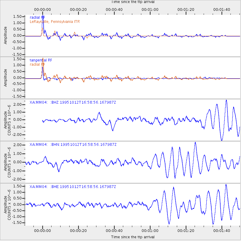
MM04 LeRaysville, Pennsylvania - Earthquake Result Viewer
*The percent match for this event was below the threshold and hence no stack was calculated.
| Earthquake location: |
Near Coast Of Jalisco, Mexico |
| Earthquake latitude/longitude: |
18.8/-104.0 |
| Earthquake time(UTC): |
1995/10/12 (285) 16:52:54 GMT |
| Earthquake Depth: |
25 km |
| Earthquake Magnitude: |
5.5 MB, 5.5 MS, 5.2 UNKNOWN, 6.0 MW |
| Earthquake Catalog/Contributor: |
WHDF/NEIC |
|
| Network: |
XA Missouri to Massachusetts Transect |
| Station: |
MM04 LeRaysville, Pennsylvania |
| Lat/Lon: |
41.85 N/76.20 W |
| Elevation: |
473 m |
|
| Distance: |
33.0 deg |
| Az: |
39.856 deg |
| Baz: |
234.337 deg |
| Ray Param: |
$rayparam |
*The percent match for this event was below the threshold and hence was not used in the summary stack. |
|
| Radial Match: |
80.72699 % |
| Radial Bump: |
400 |
| Transverse Match: |
95.72272 % |
| Transverse Bump: |
268 |
| SOD ConfigId: |
4480 |
| Insert Time: |
2010-02-26 17:45:34.386 +0000 |
| GWidth: |
2.5 |
| Max Bumps: |
400 |
| Tol: |
0.001 |
|
Signal To Noise
| Channel | StoN | STA | LTA |
| XA:MM04: :BHN:19951012T16:58:56.167987Z | 2.2499092 | 3.010678E-7 | 1.338133E-7 |
| XA:MM04: :BHE:19951012T16:58:56.167987Z | 0.8300411 | 1.349372E-7 | 1.6256688E-7 |
| XA:MM04: :BHZ:19951012T16:58:56.167987Z | 3.9699905 | 5.005848E-7 | 1.2609219E-7 |
| Arrivals |
| Ps | |
| PpPs | |
| PsPs/PpSs | |


