You are here: Home > Network List > CN - Canadian National Seismograph Network Stations List
> Station INK INUVIK, NT > Earthquake Result Viewer
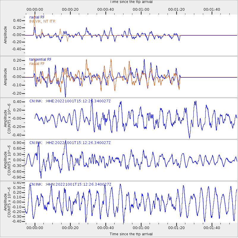
INK INUVIK, NT - Earthquake Result Viewer
*The percent match for this event was below the threshold and hence no stack was calculated.
| Earthquake location: |
Kyushu, Japan |
| Earthquake latitude/longitude: |
31.3/131.5 |
| Earthquake time(UTC): |
2022/10/01 (274) 15:02:32 GMT |
| Earthquake Depth: |
28 km |
| Earthquake Magnitude: |
5.7 mww |
| Earthquake Catalog/Contributor: |
NEIC PDE/us |
|
| Network: |
CN Canadian National Seismograph Network |
| Station: |
INK INUVIK, NT |
| Lat/Lon: |
68.31 N/133.53 W |
| Elevation: |
44 m |
|
| Distance: |
63.1 deg |
| Az: |
24.537 deg |
| Baz: |
287.072 deg |
| Ray Param: |
$rayparam |
*The percent match for this event was below the threshold and hence was not used in the summary stack. |
|
| Radial Match: |
68.37322 % |
| Radial Bump: |
400 |
| Transverse Match: |
65.955826 % |
| Transverse Bump: |
400 |
| SOD ConfigId: |
28764291 |
| Insert Time: |
2022-10-15 15:15:38.944 +0000 |
| GWidth: |
2.5 |
| Max Bumps: |
400 |
| Tol: |
0.001 |
|
Signal To Noise
| Channel | StoN | STA | LTA |
| CN:INK: :HHZ:20221001T15:12:26.340027Z | 2.111598 | 4.881046E-7 | 2.3115415E-7 |
| CN:INK: :HHN:20221001T15:12:26.340027Z | 1.1191617 | 1.5481406E-7 | 1.3833038E-7 |
| CN:INK: :HHE:20221001T15:12:26.340027Z | 1.9646323 | 2.033595E-7 | 1.0351021E-7 |
| Arrivals |
| Ps | |
| PpPs | |
| PsPs/PpSs | |


