
MM05 Gleason, Pennsylvania - Earthquake Result Viewer
| ||||||||||||||||||
| ||||||||||||||||||
| ||||||||||||||||||
|
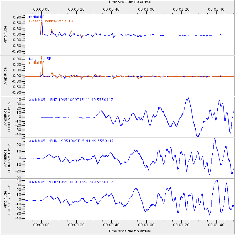
Signal To Noise
| Channel | StoN | STA | LTA |
| XA:MM05: :BHN:19951009T15:41:49.555011Z | 8.360193 | 3.2252442E-6 | 3.8578582E-7 |
| XA:MM05: :BHE:19951009T15:41:49.555011Z | 10.474748 | 5.2790983E-6 | 5.0398336E-7 |
| XA:MM05: :BHZ:19951009T15:41:49.555011Z | 16.622662 | 9.52703E-6 | 5.73135E-7 |
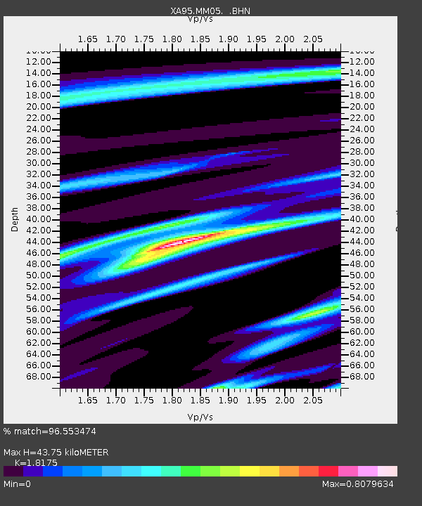
| Arrivals | |
| Ps | 6.3 SECOND |
| PpPs | 19 SECOND |
| PsPs/PpSs | 25 SECOND |

