
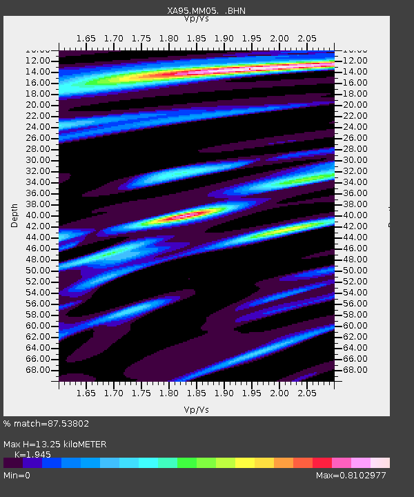
MM05 Gleason, Pennsylvania - Earthquake Result Viewer
| ||||||||||||||||||
| ||||||||||||||||||
| ||||||||||||||||||
|
Signal To Noise
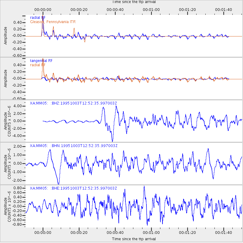
| Channel | StoN | STA | LTA |
| XA:MM05: :BHN:19951003T12:52:35.997003Z | 7.1797915 | 8.1382376E-7 | 1.13349216E-7 |
| XA:MM05: :BHE:19951003T12:52:35.997003Z | 1.1889336 | 1.6219083E-7 | 1.3641706E-7 |
| XA:MM05: :BHZ:19951003T12:52:35.997003Z | 9.399602 | 1.7390695E-6 | 1.8501522E-7 |
| Arrivals | |
| Ps | 2.2 SECOND |
| PpPs | 6.0 SECOND |
| PsPs/PpSs | 8.2 SECOND |

