MM05 Gleason, Pennsylvania - Earthquake Result Viewer
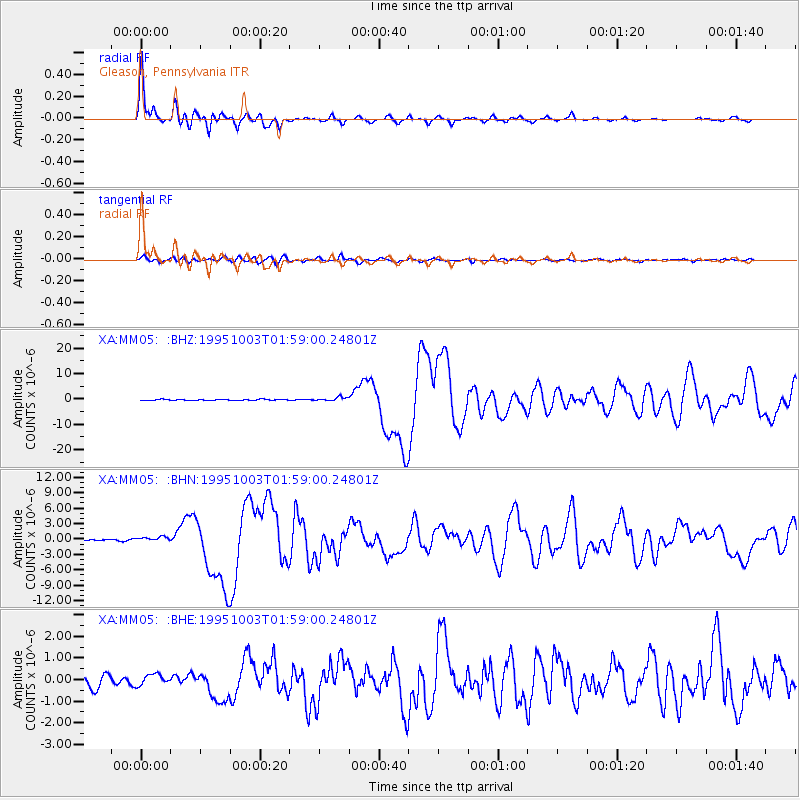
Earthquake location: Peru-Ecuador Border Region
Earthquake latitude/longitude: -2.8/-77.9
Earthquake time(UTC): 1995/10/03 (276) 01:51:24 GMT
Earthquake Depth: 27 km
Earthquake Magnitude: 6.5 MB, 7.0 MS, 6.9 UNKNOWN, 7.0 MW
Earthquake Catalog/Contributor: WHDF/NEIC
Network: XA Missouri to Massachusetts Transect
Station: MM05 Gleason, Pennsylvania
Lat/Lon: 41.65 N/76.92 W
Elevation: 701 m
Distance: 44.2 deg
Az: 1.034 deg
Baz: 181.378 deg
Ray Param: 0.07200071
Estimated Moho Depth: 40.75 km
Estimated Crust Vp/Vs: 1.81
Assumed Crust Vp: 6.121 km/s
Estimated Crust Vs: 3.377 km/s
Estimated Crust Poisson's Ratio: 0.28
Radial Match: 95.11182 %
Radial Bump: 393
Transverse Match: 85.87266 %
Transverse Bump: 400
SOD ConfigId: 6273
Insert Time: 2010-02-26 17:45:47.685 +0000
GWidth: 2.5
Max Bumps: 400
Tol: 0.001

Signal To Noise

ChannelStoNSTALTA
XA:MM05: :BHN:19951003T01:59:00.24801Z2.21073084.4155013E-71.9973038E-7
XA:MM05: :BHE:19951003T01:59:00.24801Z1.03728662.5254084E-72.4346292E-7
XA:MM05: :BHZ:19951003T01:59:00.24801Z3.71548347.435753E-72.0012882E-7
Arrivals
Ps5.7 SECOND
PpPs18 SECOND
PsPs/PpSs23 SECOND