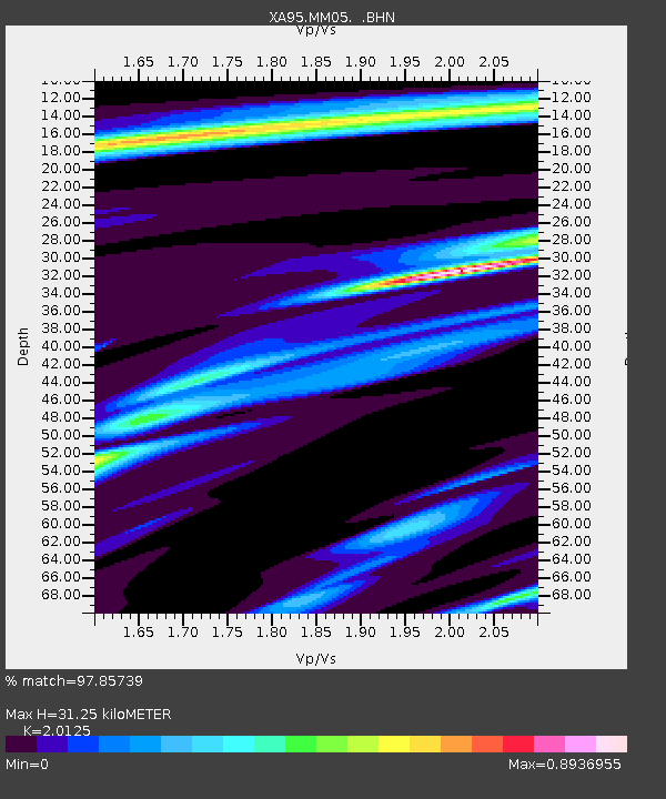
MM05 Gleason, Pennsylvania - Earthquake Result Viewer
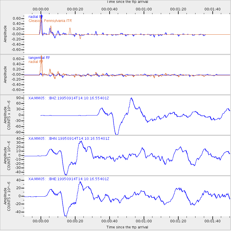
Earthquake location: Near Coast Of Guerrero, Mexico
Earthquake latitude/longitude: 16.8/-98.6
Earthquake time(UTC): 1995/09/14 (257) 14:04:31 GMT
Earthquake Depth: 21 km
Earthquake Magnitude: 6.4 MB, 7.2 MS, 7.2 UNKNOWN, 7.5 MW
Earthquake Catalog/Contributor: WHDF/NEIC
Network: XA Missouri to Massachusetts Transect
Station: MM05 Gleason, Pennsylvania
Lat/Lon: 41.65 N/76.92 W
Elevation: 701 m
Distance: 31.0 deg
Az: 32.559 deg
Baz: 223.449 deg
Ray Param: 0.07918275
Estimated Moho Depth: 31.25 km
Estimated Crust Vp/Vs: 2.01
Assumed Crust Vp: 6.121 km/s
Estimated Crust Vs: 3.041 km/s
Estimated Crust Poisson's Ratio: 0.34
Radial Match: 97.85739 %
Radial Bump: 265
Transverse Match: 84.216705 %
Transverse Bump: 400
SOD ConfigId: 6273
Insert Time: 2010-02-26 17:46:08.589 +0000
GWidth: 2.5
Max Bumps: 400
Tol: 0.001

Signal To Noise

ChannelStoNSTALTA
XA:MM05: :BHN:19950914T14:10:16.55401Z27.8686284.2377706E-61.5206241E-7
XA:MM05: :BHE:19950914T14:10:16.55401Z22.16624.606397E-62.0781174E-7
XA:MM05: :BHZ:19950914T14:10:16.55401Z39.8635641.1695941E-52.9339927E-7
Arrivals
Ps5.5 SECOND
PpPs14 SECOND
PsPs/PpSs20 SECOND