You are here: Home > Network List > US - United States National Seismic Network Stations List
> Station MNTX Cornudas Mountains, Texas, USA > Earthquake Result Viewer
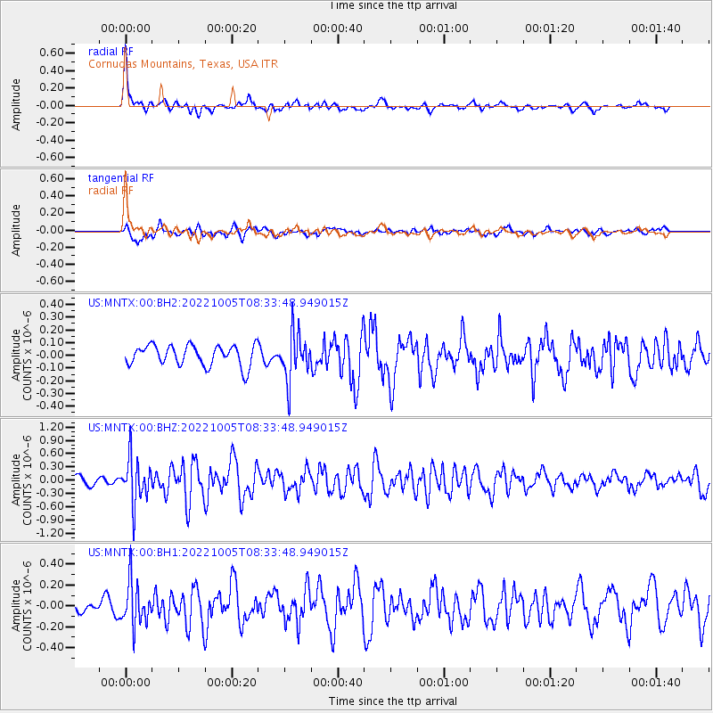
MNTX Cornudas Mountains, Texas, USA - Earthquake Result Viewer
*The percent match for this event was below the threshold and hence no stack was calculated.
| Earthquake location: |
Peru-Ecuador Border Region |
| Earthquake latitude/longitude: |
-4.9/-80.6 |
| Earthquake time(UTC): |
2022/10/05 (278) 08:26:21 GMT |
| Earthquake Depth: |
48 km |
| Earthquake Magnitude: |
5.8 Mww |
| Earthquake Catalog/Contributor: |
NEIC PDE/us |
|
| Network: |
US United States National Seismic Network |
| Station: |
MNTX Cornudas Mountains, Texas, USA |
| Lat/Lon: |
31.70 N/105.38 W |
| Elevation: |
405 m |
|
| Distance: |
43.4 deg |
| Az: |
328.625 deg |
| Baz: |
142.513 deg |
| Ray Param: |
$rayparam |
*The percent match for this event was below the threshold and hence was not used in the summary stack. |
|
| Radial Match: |
75.99921 % |
| Radial Bump: |
400 |
| Transverse Match: |
63.078587 % |
| Transverse Bump: |
400 |
| SOD ConfigId: |
28764291 |
| Insert Time: |
2022-10-19 08:57:07.334 +0000 |
| GWidth: |
2.5 |
| Max Bumps: |
400 |
| Tol: |
0.001 |
|
Signal To Noise
| Channel | StoN | STA | LTA |
| US:MNTX:00:BHZ:20221005T08:33:48.949015Z | 4.2107854 | 5.0872404E-7 | 1.2081452E-7 |
| US:MNTX:00:BH1:20221005T08:33:48.949015Z | 3.0591118 | 2.0985203E-7 | 6.859901E-8 |
| US:MNTX:00:BH2:20221005T08:33:48.949015Z | 2.316021 | 1.879737E-7 | 8.116235E-8 |
| Arrivals |
| Ps | |
| PpPs | |
| PsPs/PpSs | |


