You are here: Home > Network List > CI - Caltech Regional Seismic Network Stations List
> Station MPP McPhearson Peak > Earthquake Result Viewer
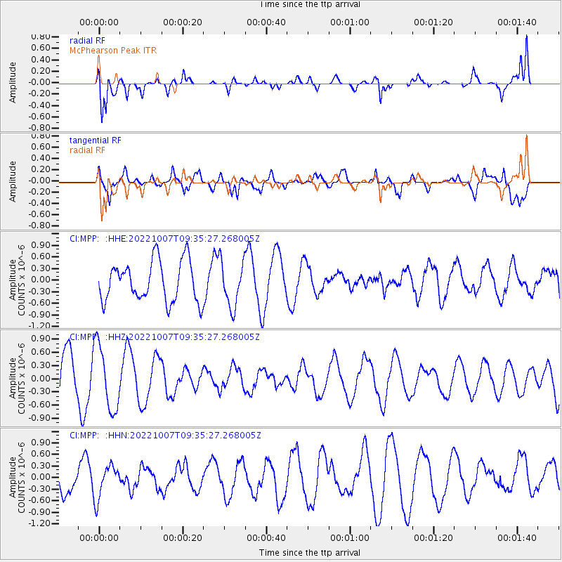
MPP McPhearson Peak - Earthquake Result Viewer
*The percent match for this event was below the threshold and hence no stack was calculated.
| Earthquake location: |
Samoa Islands |
| Earthquake latitude/longitude: |
-14.9/-172.5 |
| Earthquake time(UTC): |
2022/10/07 (280) 09:24:54 GMT |
| Earthquake Depth: |
92 km |
| Earthquake Magnitude: |
5.8 Mi |
| Earthquake Catalog/Contributor: |
NEIC PDE/pt |
|
| Network: |
CI Caltech Regional Seismic Network |
| Station: |
MPP McPhearson Peak |
| Lat/Lon: |
34.89 N/119.81 W |
| Elevation: |
1739 m |
|
| Distance: |
70.4 deg |
| Az: |
43.982 deg |
| Baz: |
234.746 deg |
| Ray Param: |
$rayparam |
*The percent match for this event was below the threshold and hence was not used in the summary stack. |
|
| Radial Match: |
79.43809 % |
| Radial Bump: |
400 |
| Transverse Match: |
70.3956 % |
| Transverse Bump: |
400 |
| SOD ConfigId: |
28764291 |
| Insert Time: |
2022-10-21 09:33:53.968 +0000 |
| GWidth: |
2.5 |
| Max Bumps: |
400 |
| Tol: |
0.001 |
|
Signal To Noise
| Channel | StoN | STA | LTA |
| CI:MPP: :HHZ:20221007T09:35:27.268005Z | 1.680827 | 7.3621464E-7 | 4.380074E-7 |
| CI:MPP: :HHN:20221007T09:35:27.268005Z | 1.0768608 | 4.2955847E-7 | 3.988988E-7 |
| CI:MPP: :HHE:20221007T09:35:27.268005Z | 1.1143572 | 5.797105E-7 | 5.202196E-7 |
| Arrivals |
| Ps | |
| PpPs | |
| PsPs/PpSs | |


