You are here: Home > Network List > CI - Caltech Regional Seismic Network Stations List
> Station TIN Tinemaha, Big Pine, CA, USA > Earthquake Result Viewer
TIN Tinemaha, Big Pine, CA, USA - Earthquake Result Viewer
*The percent match for this event was below the threshold and hence no stack was calculated.
| Earthquake location: |
Samoa Islands |
| Earthquake latitude/longitude: |
-14.9/-172.5 |
| Earthquake time(UTC): |
2022/10/07 (280) 09:24:54 GMT |
| Earthquake Depth: |
92 km |
| Earthquake Magnitude: |
5.8 Mi |
| Earthquake Catalog/Contributor: |
NEIC PDE/pt |
|
| Network: |
CI Caltech Regional Seismic Network |
| Station: |
TIN Tinemaha, Big Pine, CA, USA |
| Lat/Lon: |
37.05 N/118.23 W |
| Elevation: |
1197 m |
|
| Distance: |
72.7 deg |
| Az: |
42.891 deg |
| Baz: |
235.327 deg |
| Ray Param: |
$rayparam |
*The percent match for this event was below the threshold and hence was not used in the summary stack. |
|
| Radial Match: |
55.42712 % |
| Radial Bump: |
400 |
| Transverse Match: |
51.633522 % |
| Transverse Bump: |
400 |
| SOD ConfigId: |
28764291 |
| Insert Time: |
2022-10-21 09:34:22.055 +0000 |
| GWidth: |
2.5 |
| Max Bumps: |
400 |
| Tol: |
0.001 |
|
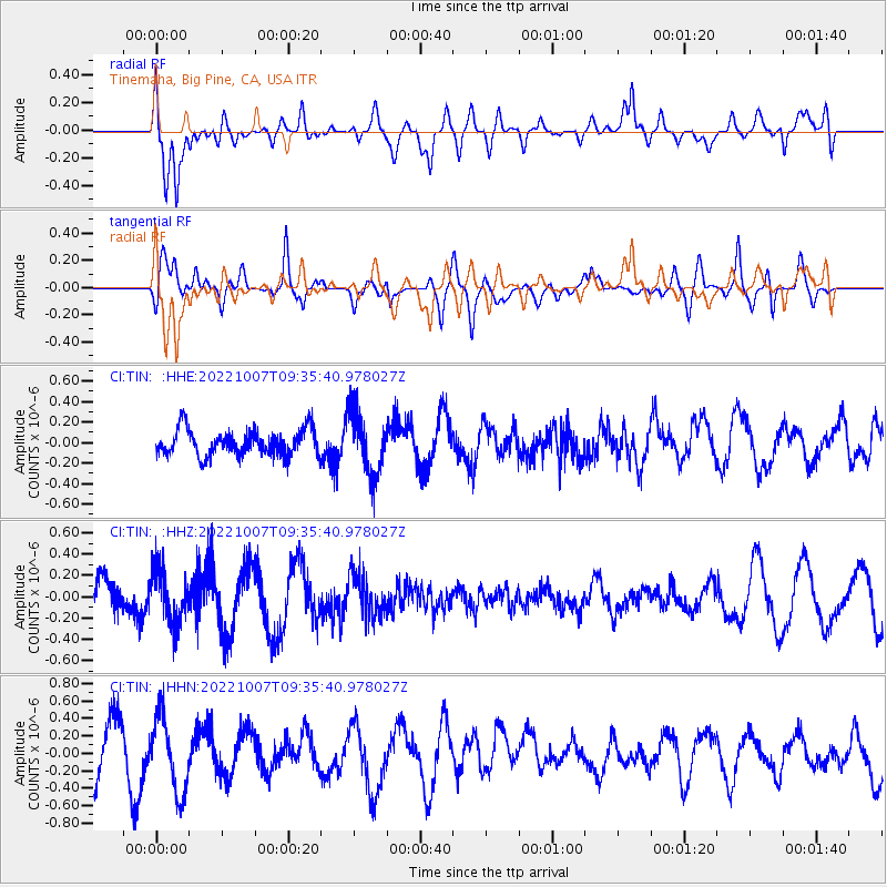
Signal To Noise
| Channel | StoN | STA | LTA |
| CI:TIN: :HHZ:20221007T09:35:40.978027Z | 1.5677767 | 2.630894E-7 | 1.678105E-7 |
| CI:TIN: :HHN:20221007T09:35:40.978027Z | 1.4658426 | 4.2950447E-7 | 2.9300858E-7 |
| CI:TIN: :HHE:20221007T09:35:40.978027Z | 2.3868656 | 3.09639E-7 | 1.297262E-7 |
| Arrivals |
| Ps | |
| PpPs | |
| PsPs/PpSs | |


