You are here: Home > Network List > XA95 - Missouri to Massachusetts Transect Stations List
> Station MM05 Gleason, Pennsylvania > Earthquake Result Viewer
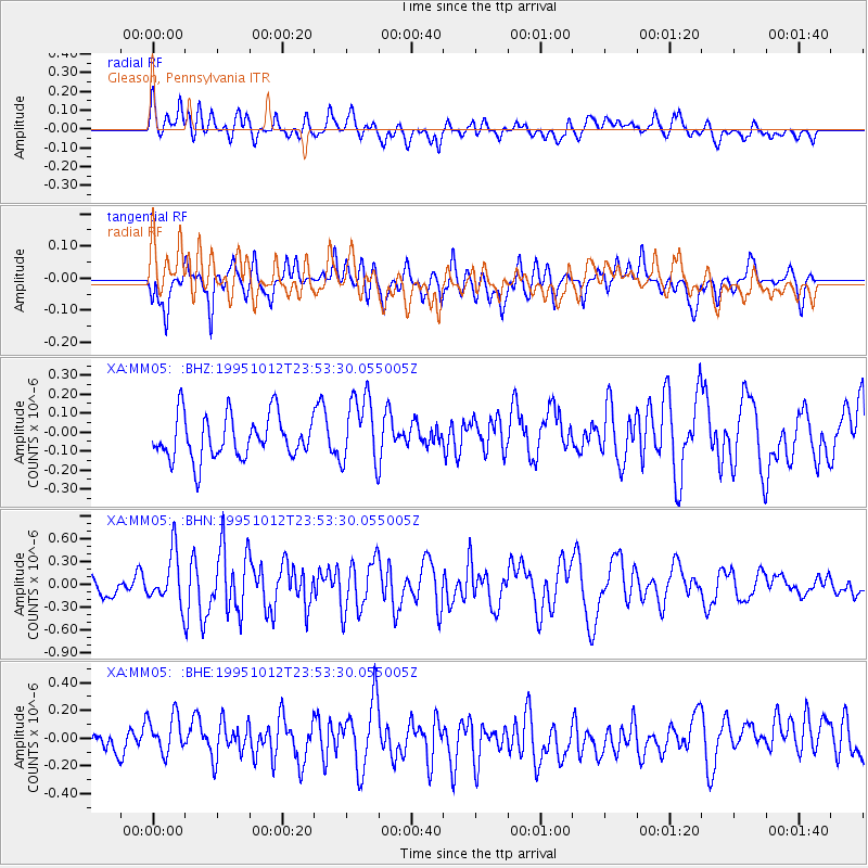
MM05 Gleason, Pennsylvania - Earthquake Result Viewer
*The percent match for this event was below the threshold and hence no stack was calculated.
| Earthquake location: |
Southern East Pacific Rise |
| Earthquake latitude/longitude: |
-35.4/-106.2 |
| Earthquake time(UTC): |
1995/10/12 (285) 23:41:45 GMT |
| Earthquake Depth: |
10 km |
| Earthquake Magnitude: |
5.5 MB, 5.3 MS, 5.9 UNKNOWN |
| Earthquake Catalog/Contributor: |
WHDF/NEIC |
|
| Network: |
XA Missouri to Massachusetts Transect |
| Station: |
MM05 Gleason, Pennsylvania |
| Lat/Lon: |
41.65 N/76.92 W |
| Elevation: |
701 m |
|
| Distance: |
81.3 deg |
| Az: |
21.779 deg |
| Baz: |
203.855 deg |
| Ray Param: |
$rayparam |
*The percent match for this event was below the threshold and hence was not used in the summary stack. |
|
| Radial Match: |
53.59358 % |
| Radial Bump: |
400 |
| Transverse Match: |
61.963917 % |
| Transverse Bump: |
400 |
| SOD ConfigId: |
4480 |
| Insert Time: |
2010-02-26 17:46:37.529 +0000 |
| GWidth: |
2.5 |
| Max Bumps: |
400 |
| Tol: |
0.001 |
|
Signal To Noise
| Channel | StoN | STA | LTA |
| XA:MM05: :BHN:19951012T23:53:30.055005Z | 2.7298646 | 3.418464E-7 | 1.2522467E-7 |
| XA:MM05: :BHE:19951012T23:53:30.055005Z | 1.8256916 | 1.4413574E-7 | 7.894857E-8 |
| XA:MM05: :BHZ:19951012T23:53:30.055005Z | 1.6525593 | 1.8667113E-7 | 1.12958816E-7 |
| Arrivals |
| Ps | |
| PpPs | |
| PsPs/PpSs | |


