You are here: Home > Network List > UW - Pacific Northwest Regional Seismic Network Stations List
> Station UMAT Pilot Rock, OR, USA > Earthquake Result Viewer
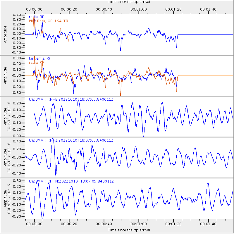
UMAT Pilot Rock, OR, USA - Earthquake Result Viewer
*The percent match for this event was below the threshold and hence no stack was calculated.
| Earthquake location: |
Fiji Islands Region |
| Earthquake latitude/longitude: |
-20.0/-176.5 |
| Earthquake time(UTC): |
2022/10/10 (283) 17:55:10 GMT |
| Earthquake Depth: |
11 km |
| Earthquake Magnitude: |
5.5 Mww |
| Earthquake Catalog/Contributor: |
NEIC PDE/us |
|
| Network: |
UW Pacific Northwest Regional Seismic Network |
| Station: |
UMAT Pilot Rock, OR, USA |
| Lat/Lon: |
45.29 N/118.96 W |
| Elevation: |
1318 m |
|
| Distance: |
83.3 deg |
| Az: |
36.85 deg |
| Baz: |
233.054 deg |
| Ray Param: |
$rayparam |
*The percent match for this event was below the threshold and hence was not used in the summary stack. |
|
| Radial Match: |
33.413586 % |
| Radial Bump: |
396 |
| Transverse Match: |
38.748966 % |
| Transverse Bump: |
353 |
| SOD ConfigId: |
28764291 |
| Insert Time: |
2022-10-24 18:16:20.529 +0000 |
| GWidth: |
2.5 |
| Max Bumps: |
400 |
| Tol: |
0.001 |
|
Signal To Noise
| Channel | StoN | STA | LTA |
| UW:UMAT: :HHZ:20221010T18:07:05.840011Z | 0.9016997 | 9.5667154E-8 | 1.06096465E-7 |
| UW:UMAT: :HHN:20221010T18:07:05.840011Z | 2.668992 | 2.1719973E-7 | 8.137893E-8 |
| UW:UMAT: :HHE:20221010T18:07:05.840011Z | 0.33573365 | 3.5871558E-8 | 1.06845285E-7 |
| Arrivals |
| Ps | |
| PpPs | |
| PsPs/PpSs | |


