You are here: Home > Network List > WY - Yellowstone Wyoming Seismic Network Stations List
> Station YHH Holmes Hill, YNP, WY, USA > Earthquake Result Viewer
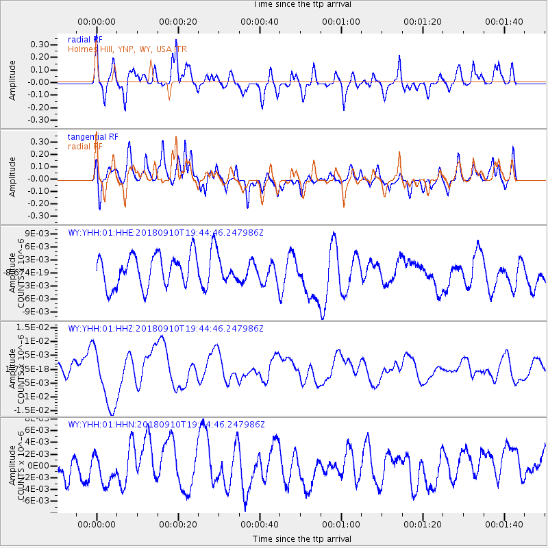
YHH Holmes Hill, YNP, WY, USA - Earthquake Result Viewer
*The percent match for this event was below the threshold and hence no stack was calculated.
| Earthquake location: |
Southeast Of Loyalty Islands |
| Earthquake latitude/longitude: |
-22.1/170.0 |
| Earthquake time(UTC): |
2018/09/10 (253) 19:31:42 GMT |
| Earthquake Depth: |
10 km |
| Earthquake Magnitude: |
6.6 Mi |
| Earthquake Catalog/Contributor: |
NEIC PDE/at |
|
| Network: |
WY Yellowstone Wyoming Seismic Network |
| Station: |
YHH Holmes Hill, YNP, WY, USA |
| Lat/Lon: |
44.79 N/110.85 W |
| Elevation: |
2717 m |
|
| Distance: |
98.0 deg |
| Az: |
44.921 deg |
| Baz: |
246.877 deg |
| Ray Param: |
$rayparam |
*The percent match for this event was below the threshold and hence was not used in the summary stack. |
|
| Radial Match: |
56.582462 % |
| Radial Bump: |
400 |
| Transverse Match: |
66.219864 % |
| Transverse Bump: |
400 |
| SOD ConfigId: |
2825771 |
| Insert Time: |
2018-09-24 19:49:11.951 +0000 |
| GWidth: |
2.5 |
| Max Bumps: |
400 |
| Tol: |
0.001 |
|
Signal To Noise
| Channel | StoN | STA | LTA |
| WY:YHH:01:HHZ:20180910T19:44:46.247986Z | 4.9134765 | 1.0889562E-8 | 2.2162643E-9 |
| WY:YHH:01:HHN:20180910T19:44:46.247986Z | 1.0703917 | 2.5352898E-9 | 2.3685627E-9 |
| WY:YHH:01:HHE:20180910T19:44:46.247986Z | 0.8035683 | 2.9089415E-9 | 3.62003E-9 |
| Arrivals |
| Ps | |
| PpPs | |
| PsPs/PpSs | |


