You are here: Home > Network List > AV - Alaska Volcano Observatory Stations List
> Station MAPS Pakushin Southeast, Makushin Volcano, Alaska > Earthquake Result Viewer
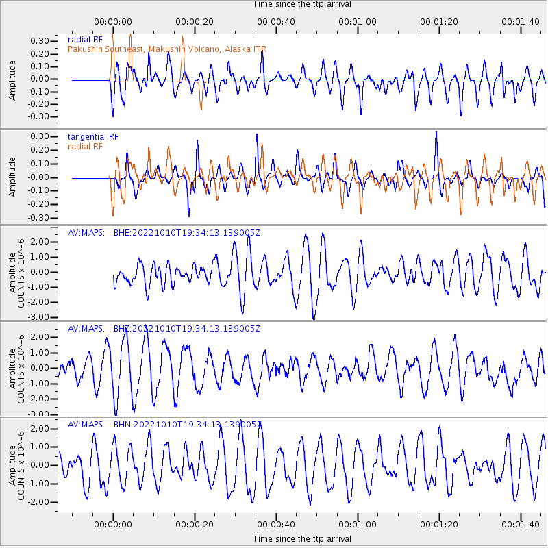
MAPS Pakushin Southeast, Makushin Volcano, Alaska - Earthquake Result Viewer
*The percent match for this event was below the threshold and hence no stack was calculated.
| Earthquake location: |
Taiwan Region |
| Earthquake latitude/longitude: |
23.9/122.3 |
| Earthquake time(UTC): |
2022/10/10 (283) 19:24:40 GMT |
| Earthquake Depth: |
18 km |
| Earthquake Magnitude: |
5.7 Mww |
| Earthquake Catalog/Contributor: |
NEIC PDE/us |
|
| Network: |
AV Alaska Volcano Observatory |
| Station: |
MAPS Pakushin Southeast, Makushin Volcano, Alaska |
| Lat/Lon: |
53.81 N/166.94 W |
| Elevation: |
333 m |
|
| Distance: |
59.8 deg |
| Az: |
40.402 deg |
| Baz: |
269.774 deg |
| Ray Param: |
$rayparam |
*The percent match for this event was below the threshold and hence was not used in the summary stack. |
|
| Radial Match: |
57.825924 % |
| Radial Bump: |
400 |
| Transverse Match: |
74.121124 % |
| Transverse Bump: |
394 |
| SOD ConfigId: |
28764291 |
| Insert Time: |
2022-10-24 19:31:32.625 +0000 |
| GWidth: |
2.5 |
| Max Bumps: |
400 |
| Tol: |
0.001 |
|
Signal To Noise
| Channel | StoN | STA | LTA |
| AV:MAPS: :BHZ:20221010T19:34:13.139005Z | 3.213347 | 1.8285142E-6 | 5.690373E-7 |
| AV:MAPS: :BHN:20221010T19:34:13.139005Z | 1.3908215 | 9.92923E-7 | 7.1391116E-7 |
| AV:MAPS: :BHE:20221010T19:34:13.139005Z | 2.7641687 | 1.6238374E-6 | 5.8745957E-7 |
| Arrivals |
| Ps | |
| PpPs | |
| PsPs/PpSs | |


