MM06 Emporium, Pennsylvania - Earthquake Result Viewer
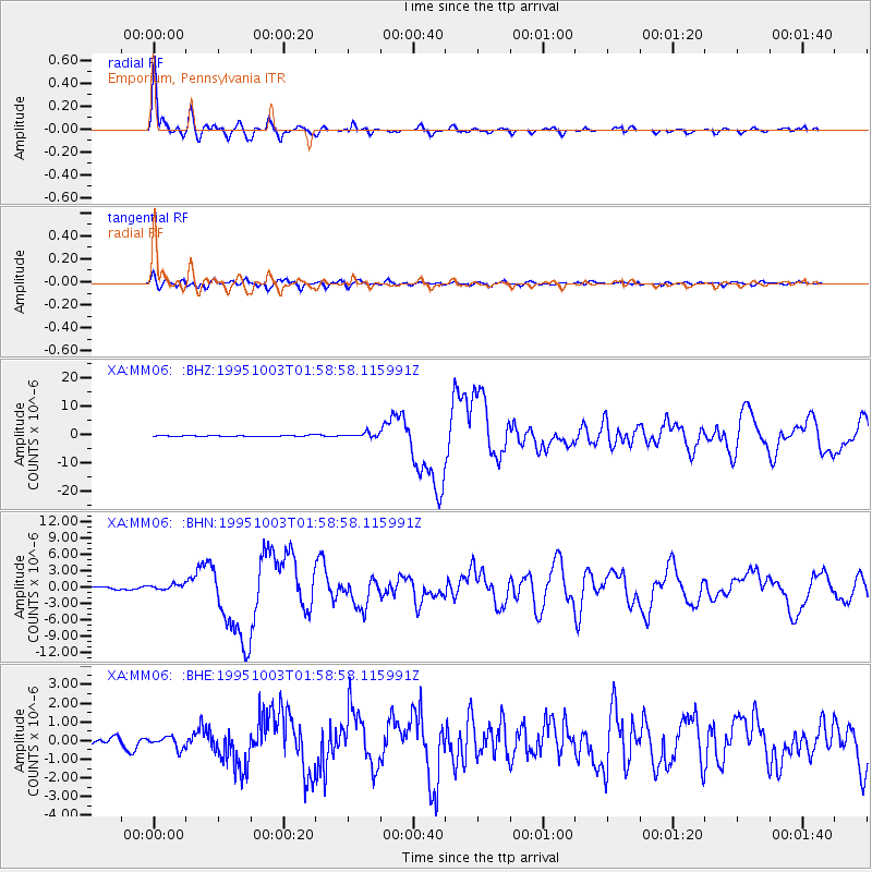
Earthquake location: Peru-Ecuador Border Region
Earthquake latitude/longitude: -2.8/-77.9
Earthquake time(UTC): 1995/10/03 (276) 01:51:24 GMT
Earthquake Depth: 27 km
Earthquake Magnitude: 6.5 MB, 7.0 MS, 6.9 UNKNOWN, 7.0 MW
Earthquake Catalog/Contributor: WHDF/NEIC
Network: XA Missouri to Massachusetts Transect
Station: MM06 Emporium, Pennsylvania
Lat/Lon: 41.39 N/78.13 W
Elevation: 647 m
Distance: 44.0 deg
Az: 359.737 deg
Baz: 179.651 deg
Ray Param: 0.0721664
Estimated Moho Depth: 14.5 km
Estimated Crust Vp/Vs: 1.60
Assumed Crust Vp: 6.121 km/s
Estimated Crust Vs: 3.825 km/s
Estimated Crust Poisson's Ratio: 0.18
Radial Match: 96.24797 %
Radial Bump: 370
Transverse Match: 85.898506 %
Transverse Bump: 400
SOD ConfigId: 6273
Insert Time: 2010-02-26 17:46:49.353 +0000
GWidth: 2.5
Max Bumps: 400
Tol: 0.001

Signal To Noise

ChannelStoNSTALTA
XA:MM06: :BHN:19951003T01:58:58.115991Z2.74583655.835889E-72.1253594E-7
XA:MM06: :BHE:19951003T01:58:58.115991Z1.80367493.146572E-71.7445339E-7
XA:MM06: :BHZ:19951003T01:58:58.115991Z3.74332888.4137434E-72.2476634E-7
Arrivals
Ps1.5 SECOND
PpPs5.8 SECOND
PsPs/PpSs7.3 SECOND