You are here: Home > Network List > IW - Intermountain West Stations List
> Station MOOW Moose Ponds, Wyoming, USA > Earthquake Result Viewer
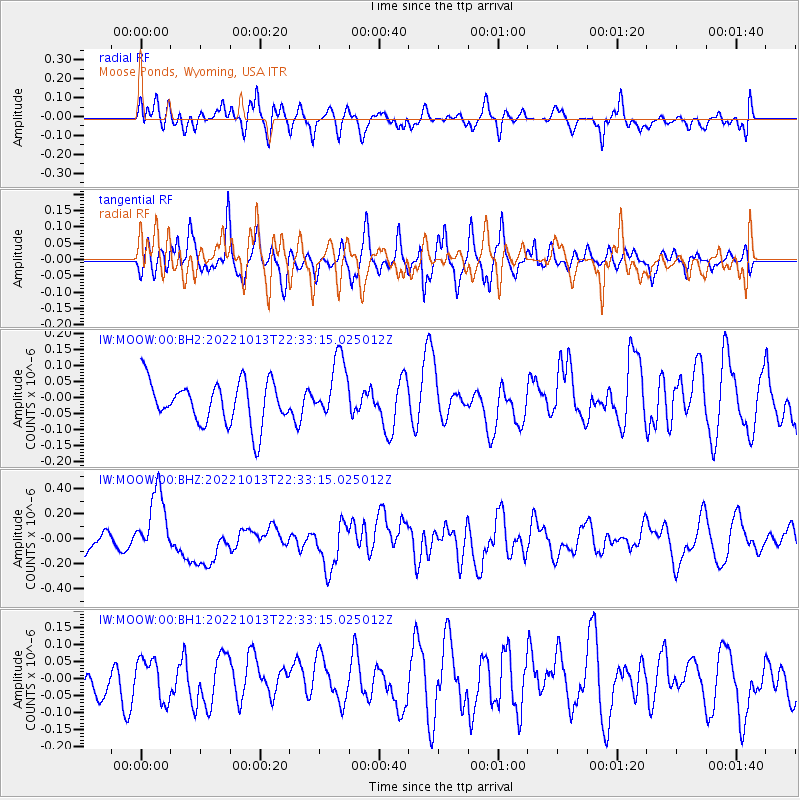
MOOW Moose Ponds, Wyoming, USA - Earthquake Result Viewer
*The percent match for this event was below the threshold and hence no stack was calculated.
| Earthquake location: |
New Ireland Region, P.N.G. |
| Earthquake latitude/longitude: |
-4.8/153.6 |
| Earthquake time(UTC): |
2022/10/13 (286) 22:20:20 GMT |
| Earthquake Depth: |
71 km |
| Earthquake Magnitude: |
6.4 mww |
| Earthquake Catalog/Contributor: |
NEIC PDE/us |
|
| Network: |
IW Intermountain West |
| Station: |
MOOW Moose Ponds, Wyoming, USA |
| Lat/Lon: |
43.75 N/110.74 W |
| Elevation: |
2128 m |
|
| Distance: |
97.4 deg |
| Az: |
46.651 deg |
| Baz: |
270.463 deg |
| Ray Param: |
$rayparam |
*The percent match for this event was below the threshold and hence was not used in the summary stack. |
|
| Radial Match: |
52.08882 % |
| Radial Bump: |
400 |
| Transverse Match: |
43.254307 % |
| Transverse Bump: |
378 |
| SOD ConfigId: |
28764291 |
| Insert Time: |
2022-10-27 22:39:11.280 +0000 |
| GWidth: |
2.5 |
| Max Bumps: |
400 |
| Tol: |
0.001 |
|
Signal To Noise
| Channel | StoN | STA | LTA |
| IW:MOOW:00:BHZ:20221013T22:33:15.025012Z | 2.873117 | 2.6296425E-7 | 9.152577E-8 |
| IW:MOOW:00:BH1:20221013T22:33:15.025012Z | 0.9370966 | 6.017357E-8 | 6.421277E-8 |
| IW:MOOW:00:BH2:20221013T22:33:15.025012Z | 1.4490324 | 9.659777E-8 | 6.6663645E-8 |
| Arrivals |
| Ps | |
| PpPs | |
| PsPs/PpSs | |


