You are here: Home > Network List > UW - Pacific Northwest Regional Seismic Network Stations List
> Station UMAT Pilot Rock, OR, USA > Earthquake Result Viewer
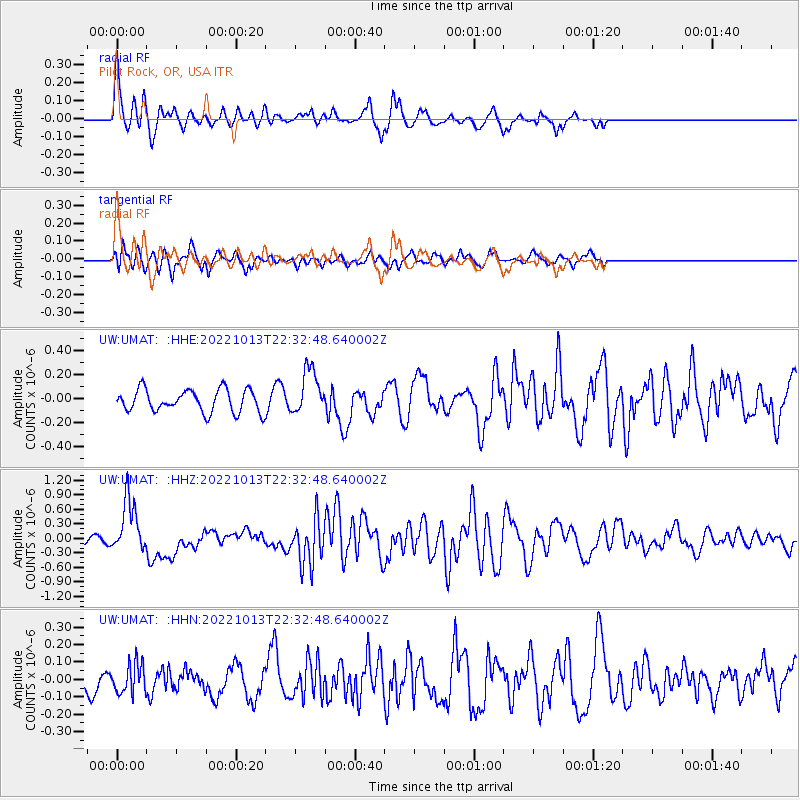
UMAT Pilot Rock, OR, USA - Earthquake Result Viewer
*The percent match for this event was below the threshold and hence no stack was calculated.
| Earthquake location: |
New Ireland Region, P.N.G. |
| Earthquake latitude/longitude: |
-4.8/153.6 |
| Earthquake time(UTC): |
2022/10/13 (286) 22:20:20 GMT |
| Earthquake Depth: |
71 km |
| Earthquake Magnitude: |
6.4 mww |
| Earthquake Catalog/Contributor: |
NEIC PDE/us |
|
| Network: |
UW Pacific Northwest Regional Seismic Network |
| Station: |
UMAT Pilot Rock, OR, USA |
| Lat/Lon: |
45.29 N/118.96 W |
| Elevation: |
1318 m |
|
| Distance: |
91.6 deg |
| Az: |
44.869 deg |
| Baz: |
264.858 deg |
| Ray Param: |
$rayparam |
*The percent match for this event was below the threshold and hence was not used in the summary stack. |
|
| Radial Match: |
62.294785 % |
| Radial Bump: |
328 |
| Transverse Match: |
51.416595 % |
| Transverse Bump: |
400 |
| SOD ConfigId: |
28764291 |
| Insert Time: |
2022-10-27 22:48:42.135 +0000 |
| GWidth: |
2.5 |
| Max Bumps: |
400 |
| Tol: |
0.001 |
|
Signal To Noise
| Channel | StoN | STA | LTA |
| UW:UMAT: :HHZ:20221013T22:32:48.640002Z | 5.3403506 | 5.5201696E-7 | 1.0336718E-7 |
| UW:UMAT: :HHN:20221013T22:32:48.640002Z | 0.89524436 | 8.422564E-8 | 9.408117E-8 |
| UW:UMAT: :HHE:20221013T22:32:48.640002Z | 1.9997178 | 1.8560206E-7 | 9.2814126E-8 |
| Arrivals |
| Ps | |
| PpPs | |
| PsPs/PpSs | |


