You are here: Home > Network List > UU - University of Utah Regional Network Stations List
> Station CCUT Cedar City, UT, USA > Earthquake Result Viewer
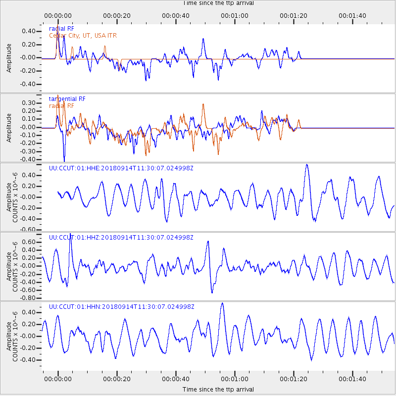
CCUT Cedar City, UT, USA - Earthquake Result Viewer
*The percent match for this event was below the threshold and hence no stack was calculated.
| Earthquake location: |
Southern Peru |
| Earthquake latitude/longitude: |
-16.0/-71.5 |
| Earthquake time(UTC): |
2018/09/14 (257) 11:20:02 GMT |
| Earthquake Depth: |
121 km |
| Earthquake Magnitude: |
5.4 Mww |
| Earthquake Catalog/Contributor: |
NEIC PDE/us |
|
| Network: |
UU University of Utah Regional Network |
| Station: |
CCUT Cedar City, UT, USA |
| Lat/Lon: |
37.55 N/113.36 W |
| Elevation: |
2127 m |
|
| Distance: |
66.3 deg |
| Az: |
324.592 deg |
| Baz: |
135.498 deg |
| Ray Param: |
$rayparam |
*The percent match for this event was below the threshold and hence was not used in the summary stack. |
|
| Radial Match: |
61.268578 % |
| Radial Bump: |
400 |
| Transverse Match: |
65.89467 % |
| Transverse Bump: |
400 |
| SOD ConfigId: |
2825771 |
| Insert Time: |
2018-09-28 11:28:48.811 +0000 |
| GWidth: |
2.5 |
| Max Bumps: |
400 |
| Tol: |
0.001 |
|
Signal To Noise
| Channel | StoN | STA | LTA |
| UU:CCUT:01:HHZ:20180914T11:30:07.024998Z | 2.5155954 | 3.987809E-7 | 1.5852346E-7 |
| UU:CCUT:01:HHN:20180914T11:30:07.024998Z | 1.3785653 | 2.2155959E-7 | 1.6071752E-7 |
| UU:CCUT:01:HHE:20180914T11:30:07.024998Z | 1.2438024 | 1.7934619E-7 | 1.4419186E-7 |
| Arrivals |
| Ps | |
| PpPs | |
| PsPs/PpSs | |


