You are here: Home > Network List > US - United States National Seismic Network Stations List
> Station HLID Hailey, Idaho, USA > Earthquake Result Viewer
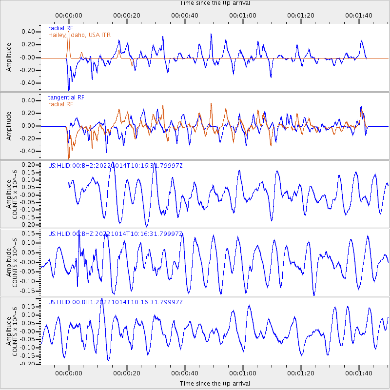
HLID Hailey, Idaho, USA - Earthquake Result Viewer
*The percent match for this event was below the threshold and hence no stack was calculated.
| Earthquake location: |
Fiji Islands Region |
| Earthquake latitude/longitude: |
-20.9/-178.7 |
| Earthquake time(UTC): |
2022/10/14 (287) 10:05:17 GMT |
| Earthquake Depth: |
566 km |
| Earthquake Magnitude: |
5.5 Mww |
| Earthquake Catalog/Contributor: |
NEIC PDE/us |
|
| Network: |
US United States National Seismic Network |
| Station: |
HLID Hailey, Idaho, USA |
| Lat/Lon: |
43.56 N/114.41 W |
| Elevation: |
1772 m |
|
| Distance: |
87.1 deg |
| Az: |
40.974 deg |
| Baz: |
237.487 deg |
| Ray Param: |
$rayparam |
*The percent match for this event was below the threshold and hence was not used in the summary stack. |
|
| Radial Match: |
57.35057 % |
| Radial Bump: |
400 |
| Transverse Match: |
57.79051 % |
| Transverse Bump: |
400 |
| SOD ConfigId: |
28764291 |
| Insert Time: |
2022-10-28 10:24:50.995 +0000 |
| GWidth: |
2.5 |
| Max Bumps: |
400 |
| Tol: |
0.001 |
|
Signal To Noise
| Channel | StoN | STA | LTA |
| US:HLID:00:BHZ:20221014T10:16:31.79997Z | 1.124439 | 5.937961E-8 | 5.2808208E-8 |
| US:HLID:00:BH1:20221014T10:16:31.79997Z | 0.86234957 | 4.5923304E-8 | 5.32537E-8 |
| US:HLID:00:BH2:20221014T10:16:31.79997Z | 1.3448217 | 1.2500571E-7 | 9.2953364E-8 |
| Arrivals |
| Ps | |
| PpPs | |
| PsPs/PpSs | |


