You are here: Home > Network List > US - United States National Seismic Network Stations List
> Station AGMN Agassiz National Wildlife Refuge, Minnesota, USA > Earthquake Result Viewer
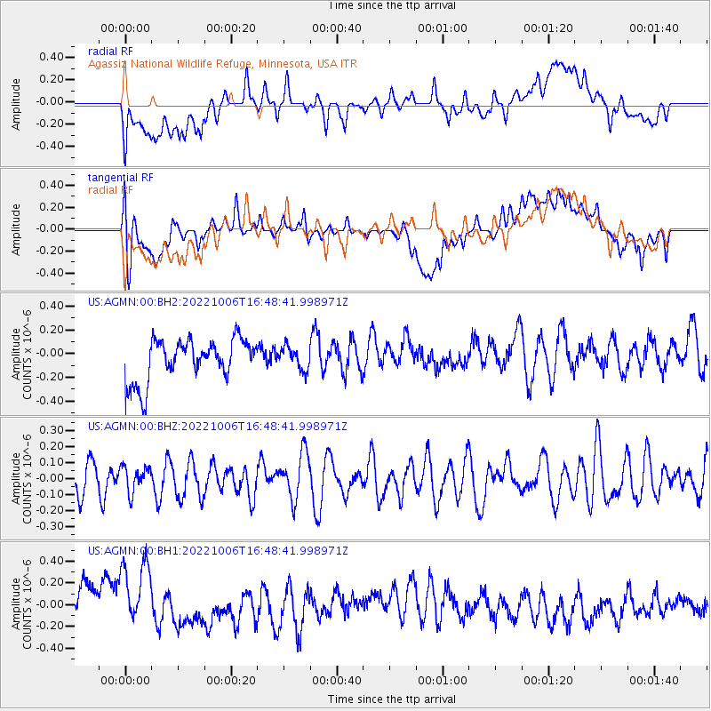
AGMN Agassiz National Wildlife Refuge, Minnesota, USA - Earthquake Result Viewer
*The percent match for this event was below the threshold and hence no stack was calculated.
| Earthquake location: |
Northwest Of Ryukyu Islands |
| Earthquake latitude/longitude: |
27.7/126.9 |
| Earthquake time(UTC): |
2022/10/06 (279) 16:36:10 GMT |
| Earthquake Depth: |
179 km |
| Earthquake Magnitude: |
5.3 mww |
| Earthquake Catalog/Contributor: |
NEIC PDE/us |
|
| Network: |
US United States National Seismic Network |
| Station: |
AGMN Agassiz National Wildlife Refuge, Minnesota, USA |
| Lat/Lon: |
48.30 N/95.86 W |
| Elevation: |
351 m |
|
| Distance: |
95.2 deg |
| Az: |
27.058 deg |
| Baz: |
322.824 deg |
| Ray Param: |
$rayparam |
*The percent match for this event was below the threshold and hence was not used in the summary stack. |
|
| Radial Match: |
48.509075 % |
| Radial Bump: |
400 |
| Transverse Match: |
48.98123 % |
| Transverse Bump: |
400 |
| SOD ConfigId: |
28764291 |
| Insert Time: |
2022-11-02 20:37:21.069 +0000 |
| GWidth: |
2.5 |
| Max Bumps: |
400 |
| Tol: |
0.001 |
|
Signal To Noise
| Channel | StoN | STA | LTA |
| US:AGMN:00:BHZ:20221006T16:48:41.998971Z | 0.7826059 | 8.1754486E-8 | 1.0446444E-7 |
| US:AGMN:00:BH1:20221006T16:48:41.998971Z | 2.301725 | 3.6281693E-7 | 1.5762826E-7 |
| US:AGMN:00:BH2:20221006T16:48:41.998971Z | 0.5426311 | 9.576429E-8 | 1.7648141E-7 |
| Arrivals |
| Ps | |
| PpPs | |
| PsPs/PpSs | |


