You are here: Home > Network List > IU - Global Seismograph Network (GSN - IRIS/USGS) Stations List
> Station JOHN Johnston Island, USA > Earthquake Result Viewer
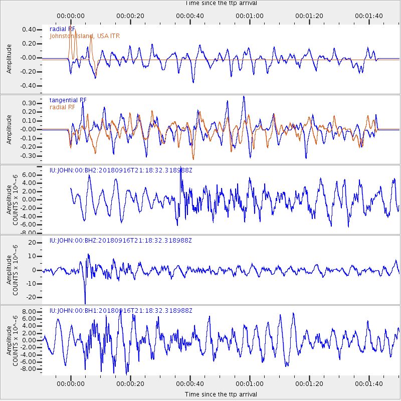
JOHN Johnston Island, USA - Earthquake Result Viewer
*The percent match for this event was below the threshold and hence no stack was calculated.
| Earthquake location: |
South Of Fiji Islands |
| Earthquake latitude/longitude: |
-25.5/178.2 |
| Earthquake time(UTC): |
2018/09/16 (259) 21:11:48 GMT |
| Earthquake Depth: |
570 km |
| Earthquake Magnitude: |
6.5 Mww |
| Earthquake Catalog/Contributor: |
NEIC PDE/us |
|
| Network: |
IU Global Seismograph Network (GSN - IRIS/USGS) |
| Station: |
JOHN Johnston Island, USA |
| Lat/Lon: |
16.73 N/169.53 W |
| Elevation: |
2.0 m |
|
| Distance: |
43.6 deg |
| Az: |
17.149 deg |
| Baz: |
196.153 deg |
| Ray Param: |
$rayparam |
*The percent match for this event was below the threshold and hence was not used in the summary stack. |
|
| Radial Match: |
40.22482 % |
| Radial Bump: |
400 |
| Transverse Match: |
62.30357 % |
| Transverse Bump: |
400 |
| SOD ConfigId: |
2825771 |
| Insert Time: |
2018-09-30 21:24:34.640 +0000 |
| GWidth: |
2.5 |
| Max Bumps: |
400 |
| Tol: |
0.001 |
|
Signal To Noise
| Channel | StoN | STA | LTA |
| IU:JOHN:00:BHZ:20180916T21:18:32.318988Z | 3.7415674 | 5.4908023E-6 | 1.4675139E-6 |
| IU:JOHN:00:BH1:20180916T21:18:32.318988Z | 1.0714389 | 2.394105E-6 | 2.2344764E-6 |
| IU:JOHN:00:BH2:20180916T21:18:32.318988Z | 0.30490276 | 7.7827576E-7 | 2.5525376E-6 |
| Arrivals |
| Ps | |
| PpPs | |
| PsPs/PpSs | |


