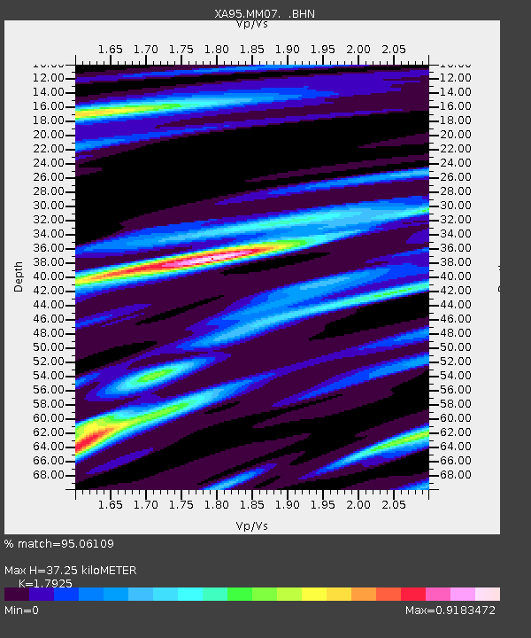
MM07 Sigel, Pennsylvania - Earthquake Result Viewer

Earthquake location: Near Coast Of Jalisco, Mexico
Earthquake latitude/longitude: 19.1/-104.2
Earthquake time(UTC): 1995/10/09 (282) 15:35:55 GMT
Earthquake Depth: 49 km
Earthquake Magnitude: 6.5 MB, 7.3 MS, 7.3 UNKNOWN, 7.9 MW
Earthquake Catalog/Contributor: WHDF/NEIC
Network: XA Missouri to Massachusetts Transect
Station: MM07 Sigel, Pennsylvania
Lat/Lon: 41.26 N/79.14 W
Elevation: 518 m
Distance: 30.7 deg
Az: 38.74 deg
Baz: 231.689 deg
Ray Param: 0.07919733
Estimated Moho Depth: 37.25 km
Estimated Crust Vp/Vs: 1.79
Assumed Crust Vp: 6.121 km/s
Estimated Crust Vs: 3.415 km/s
Estimated Crust Poisson's Ratio: 0.27
Radial Match: 95.06109 %
Radial Bump: 258
Transverse Match: 74.613846 %
Transverse Bump: 400
SOD ConfigId: 6273
Insert Time: 2010-02-26 17:47:31.956 +0000
GWidth: 2.5
Max Bumps: 400
Tol: 0.001

Signal To Noise

ChannelStoNSTALTA
XA:MM07: :BHN:19951009T15:41:35.822986Z10.0231223.9777988E-63.9686225E-7
XA:MM07: :BHE:19951009T15:41:35.822986Z12.1167925.3401736E-64.4072507E-7
XA:MM07: :BHZ:19951009T15:41:35.822986Z24.0833059.88669E-64.105205E-7
Arrivals
Ps5.2 SECOND
PpPs16 SECOND
PsPs/PpSs21 SECOND