MM07 Sigel, Pennsylvania - Earthquake Result Viewer
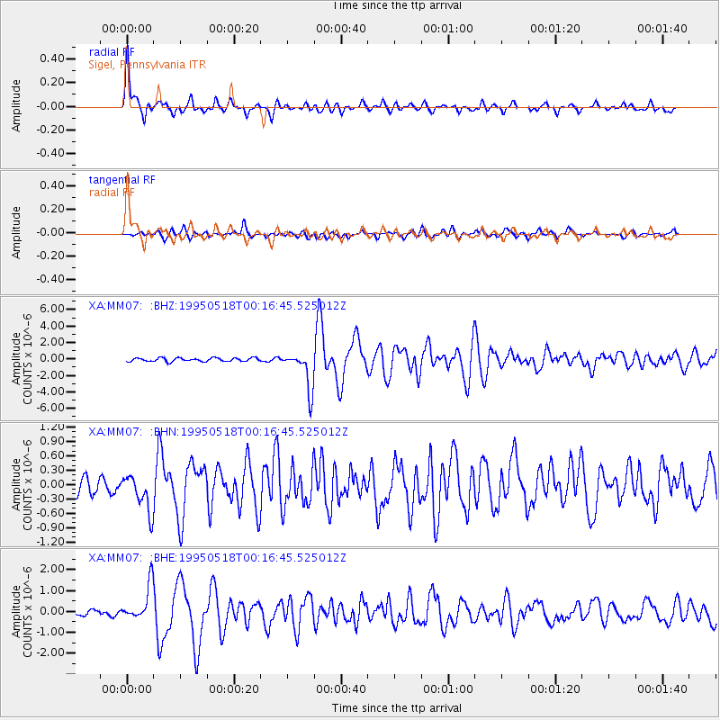
Earthquake location: Central Mid-Atlantic Ridge
Earthquake latitude/longitude: -0.9/-22.0
Earthquake time(UTC): 1995/05/18 (138) 00:06:26 GMT
Earthquake Depth: 10 km
Earthquake Magnitude: 6.2 MB, 6.1 MS, 6.8 UNKNOWN, 6.7 MW
Earthquake Catalog/Contributor: WHDF/NEIC
Network: XA Missouri to Massachusetts Transect
Station: MM07 Sigel, Pennsylvania
Lat/Lon: 41.26 N/79.14 W
Elevation: 518 m
Distance: 66.5 deg
Az: 316.334 deg
Baz: 113.699 deg
Ray Param: 0.05754869
Estimated Moho Depth: 35.25 km
Estimated Crust Vp/Vs: 1.99
Assumed Crust Vp: 6.121 km/s
Estimated Crust Vs: 3.083 km/s
Estimated Crust Poisson's Ratio: 0.33
Radial Match: 92.182335 %
Radial Bump: 400
Transverse Match: 73.503494 %
Transverse Bump: 400
SOD ConfigId: 6273
Insert Time: 2010-02-26 17:47:46.926 +0000
GWidth: 2.5
Max Bumps: 400
Tol: 0.001

Signal To Noise

ChannelStoNSTALTA
XA:MM07: :BHN:19950518T00:16:45.525012Z2.14136484.0398047E-71.8865559E-7
XA:MM07: :BHE:19950518T00:16:45.525012Z6.20762358.8135516E-71.4197948E-7
XA:MM07: :BHZ:19950518T00:16:45.525012Z11.5256372.416511E-62.09664E-7
Arrivals
Ps5.9 SECOND
PpPs17 SECOND
PsPs/PpSs23 SECOND