MM07 Sigel, Pennsylvania - Earthquake Result Viewer
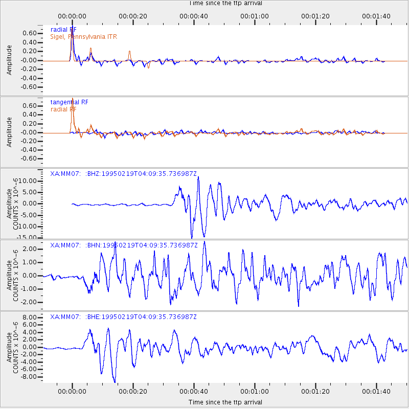
Earthquake location: Off Coast Of Northern California
Earthquake latitude/longitude: 40.6/-125.5
Earthquake time(UTC): 1995/02/19 (050) 04:03:16 GMT
Earthquake Depth: 10 km
Earthquake Magnitude: 6.1 MB, 6.8 MS, 6.7 UNKNOWN, 6.6 MD
Earthquake Catalog/Contributor: WHDF/NEIC
Network: XA Missouri to Massachusetts Transect
Station: MM07 Sigel, Pennsylvania
Lat/Lon: 41.26 N/79.14 W
Elevation: 518 m
Distance: 34.7 deg
Az: 73.31 deg
Baz: 284.546 deg
Ray Param: 0.07758295
Estimated Moho Depth: 39.75 km
Estimated Crust Vp/Vs: 1.90
Assumed Crust Vp: 6.121 km/s
Estimated Crust Vs: 3.217 km/s
Estimated Crust Poisson's Ratio: 0.31
Radial Match: 94.24345 %
Radial Bump: 398
Transverse Match: 77.90691 %
Transverse Bump: 400
SOD ConfigId: 6273
Insert Time: 2010-02-26 17:47:55.350 +0000
GWidth: 2.5
Max Bumps: 400
Tol: 0.001

Signal To Noise

ChannelStoNSTALTA
XA:MM07: :BHN:19950219T04:09:35.736987Z1.28162852.861161E-72.2324416E-7
XA:MM07: :BHE:19950219T04:09:35.736987Z4.5457698.3899863E-71.8456691E-7
XA:MM07: :BHZ:19950219T04:09:35.736987Z7.44873481.8210916E-62.4448335E-7
Arrivals
Ps6.2 SECOND
PpPs18 SECOND
PsPs/PpSs24 SECOND