MM07 Sigel, Pennsylvania - Earthquake Result Viewer
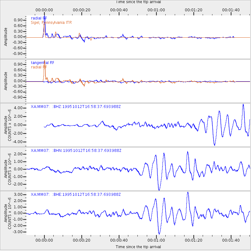
Earthquake location: Near Coast Of Jalisco, Mexico
Earthquake latitude/longitude: 18.8/-104.0
Earthquake time(UTC): 1995/10/12 (285) 16:52:54 GMT
Earthquake Depth: 25 km
Earthquake Magnitude: 5.5 MB, 5.5 MS, 5.2 UNKNOWN, 6.0 MW
Earthquake Catalog/Contributor: WHDF/NEIC
Network: XA Missouri to Massachusetts Transect
Station: MM07 Sigel, Pennsylvania
Lat/Lon: 41.26 N/79.14 W
Elevation: 518 m
Distance: 30.8 deg
Az: 38.222 deg
Baz: 231.008 deg
Ray Param: 0.07920743
Estimated Moho Depth: 23.0 km
Estimated Crust Vp/Vs: 2.08
Assumed Crust Vp: 6.121 km/s
Estimated Crust Vs: 2.946 km/s
Estimated Crust Poisson's Ratio: 0.35
Radial Match: 93.491196 %
Radial Bump: 372
Transverse Match: 63.104774 %
Transverse Bump: 400
SOD ConfigId: 6273
Insert Time: 2010-02-26 17:48:05.533 +0000
GWidth: 2.5
Max Bumps: 400
Tol: 0.001

Signal To Noise

ChannelStoNSTALTA
XA:MM07: :BHN:19951012T16:58:37.693988Z1.94934962.1556177E-71.1058138E-7
XA:MM07: :BHE:19951012T16:58:37.693988Z2.25770472.9476882E-71.3056128E-7
XA:MM07: :BHZ:19951012T16:58:37.693988Z2.59395364.7543378E-71.8328538E-7
Arrivals
Ps4.3 SECOND
PpPs11 SECOND
PsPs/PpSs15 SECOND