You are here: Home > Network List > IU - Global Seismograph Network (GSN - IRIS/USGS) Stations List
> Station PMG Port Moresby, New Guinea > Earthquake Result Viewer
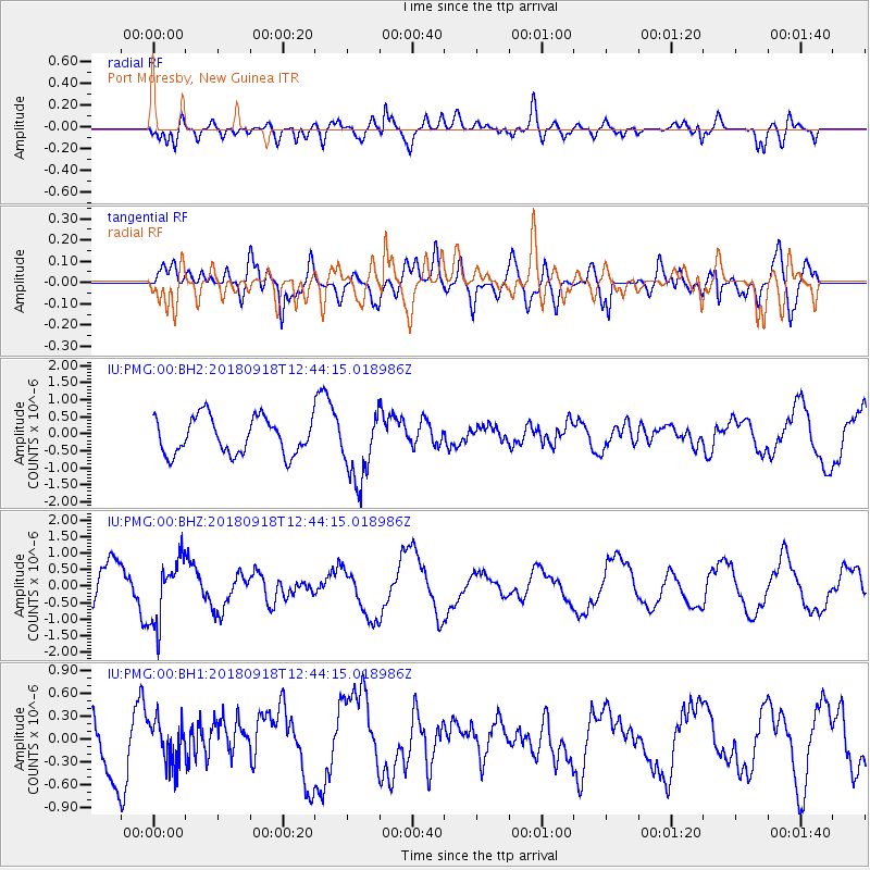
PMG Port Moresby, New Guinea - Earthquake Result Viewer
*The percent match for this event was below the threshold and hence no stack was calculated.
| Earthquake location: |
Fiji Islands Region |
| Earthquake latitude/longitude: |
-20.5/-178.2 |
| Earthquake time(UTC): |
2018/09/18 (261) 12:38:35 GMT |
| Earthquake Depth: |
516 km |
| Earthquake Magnitude: |
5.5 Mww |
| Earthquake Catalog/Contributor: |
NEIC PDE/us |
|
| Network: |
IU Global Seismograph Network (GSN - IRIS/USGS) |
| Station: |
PMG Port Moresby, New Guinea |
| Lat/Lon: |
9.40 S/147.16 E |
| Elevation: |
90 m |
|
| Distance: |
35.1 deg |
| Az: |
283.138 deg |
| Baz: |
112.325 deg |
| Ray Param: |
$rayparam |
*The percent match for this event was below the threshold and hence was not used in the summary stack. |
|
| Radial Match: |
68.09927 % |
| Radial Bump: |
400 |
| Transverse Match: |
59.305817 % |
| Transverse Bump: |
400 |
| SOD ConfigId: |
2825771 |
| Insert Time: |
2018-10-02 12:41:24.858 +0000 |
| GWidth: |
2.5 |
| Max Bumps: |
400 |
| Tol: |
0.001 |
|
Signal To Noise
| Channel | StoN | STA | LTA |
| IU:PMG:00:BHZ:20180918T12:44:15.018986Z | 1.9573095 | 9.850424E-7 | 5.0326355E-7 |
| IU:PMG:00:BH1:20180918T12:44:15.018986Z | 0.68042475 | 2.8641463E-7 | 4.209351E-7 |
| IU:PMG:00:BH2:20180918T12:44:15.018986Z | 1.9203461 | 1.0245291E-6 | 5.335127E-7 |
| Arrivals |
| Ps | |
| PpPs | |
| PsPs/PpSs | |


