You are here: Home > Network List > IW - Intermountain West Stations List
> Station MOOW Moose Ponds, Wyoming, USA > Earthquake Result Viewer
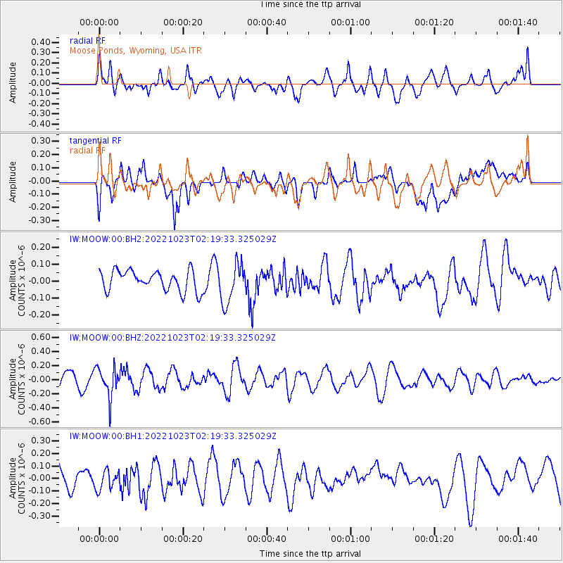
MOOW Moose Ponds, Wyoming, USA - Earthquake Result Viewer
*The percent match for this event was below the threshold and hence no stack was calculated.
| Earthquake location: |
Chile-Bolivia Border Region |
| Earthquake latitude/longitude: |
-22.0/-68.7 |
| Earthquake time(UTC): |
2022/10/23 (296) 02:08:29 GMT |
| Earthquake Depth: |
106 km |
| Earthquake Magnitude: |
5.1 Mww |
| Earthquake Catalog/Contributor: |
NEIC PDE/us |
|
| Network: |
IW Intermountain West |
| Station: |
MOOW Moose Ponds, Wyoming, USA |
| Lat/Lon: |
43.75 N/110.74 W |
| Elevation: |
2128 m |
|
| Distance: |
75.9 deg |
| Az: |
330.003 deg |
| Baz: |
140.177 deg |
| Ray Param: |
$rayparam |
*The percent match for this event was below the threshold and hence was not used in the summary stack. |
|
| Radial Match: |
49.869167 % |
| Radial Bump: |
400 |
| Transverse Match: |
46.648598 % |
| Transverse Bump: |
400 |
| SOD ConfigId: |
28764291 |
| Insert Time: |
2022-11-06 02:21:50.783 +0000 |
| GWidth: |
2.5 |
| Max Bumps: |
400 |
| Tol: |
0.001 |
|
Signal To Noise
| Channel | StoN | STA | LTA |
| IW:MOOW:00:BHZ:20221023T02:19:33.325029Z | 1.9226663 | 2.081357E-7 | 1.0825368E-7 |
| IW:MOOW:00:BH1:20221023T02:19:33.325029Z | 0.85678905 | 7.733384E-8 | 9.026007E-8 |
| IW:MOOW:00:BH2:20221023T02:19:33.325029Z | 2.0149035 | 1.2035495E-7 | 5.973237E-8 |
| Arrivals |
| Ps | |
| PpPs | |
| PsPs/PpSs | |


