You are here: Home > Network List > XA95 - Missouri to Massachusetts Transect Stations List
> Station MM07 Sigel, Pennsylvania > Earthquake Result Viewer
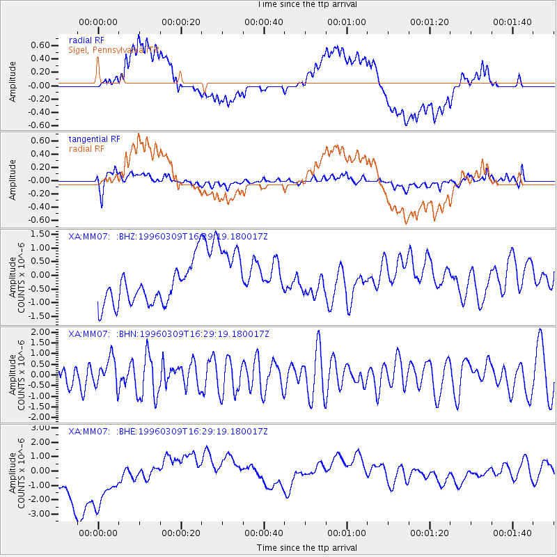
MM07 Sigel, Pennsylvania - Earthquake Result Viewer
*The percent match for this event was below the threshold and hence no stack was calculated.
| Earthquake location: |
Kuril Islands |
| Earthquake latitude/longitude: |
43.7/147.8 |
| Earthquake time(UTC): |
1996/03/09 (069) 16:17:16 GMT |
| Earthquake Depth: |
33 km |
| Earthquake Magnitude: |
5.7 MB, 6.0 MS |
| Earthquake Catalog/Contributor: |
WHDF/NEIC |
|
| Network: |
XA Missouri to Massachusetts Transect |
| Station: |
MM07 Sigel, Pennsylvania |
| Lat/Lon: |
41.26 N/79.14 W |
| Elevation: |
518 m |
|
| Distance: |
85.4 deg |
| Az: |
33.561 deg |
| Baz: |
327.886 deg |
| Ray Param: |
$rayparam |
*The percent match for this event was below the threshold and hence was not used in the summary stack. |
|
| Radial Match: |
44.846146 % |
| Radial Bump: |
400 |
| Transverse Match: |
66.97328 % |
| Transverse Bump: |
400 |
| SOD ConfigId: |
4480 |
| Insert Time: |
2010-02-26 17:48:17.201 +0000 |
| GWidth: |
2.5 |
| Max Bumps: |
400 |
| Tol: |
0.001 |
|
Signal To Noise
| Channel | StoN | STA | LTA |
| XA:MM07: :BHN:19960309T16:29:19.180017Z | 1.508433 | 6.953466E-7 | 4.609728E-7 |
| XA:MM07: :BHE:19960309T16:29:19.180017Z | 1.7827601 | 2.811183E-6 | 1.5768712E-6 |
| XA:MM07: :BHZ:19960309T16:29:19.180017Z | 1.9065243 | 1.2968102E-6 | 6.80196E-7 |
| Arrivals |
| Ps | |
| PpPs | |
| PsPs/PpSs | |


