You are here: Home > Network List > AV - Alaska Volcano Observatory Stations List
> Station MAPS Pakushin Southeast, Makushin Volcano, Alaska > Earthquake Result Viewer
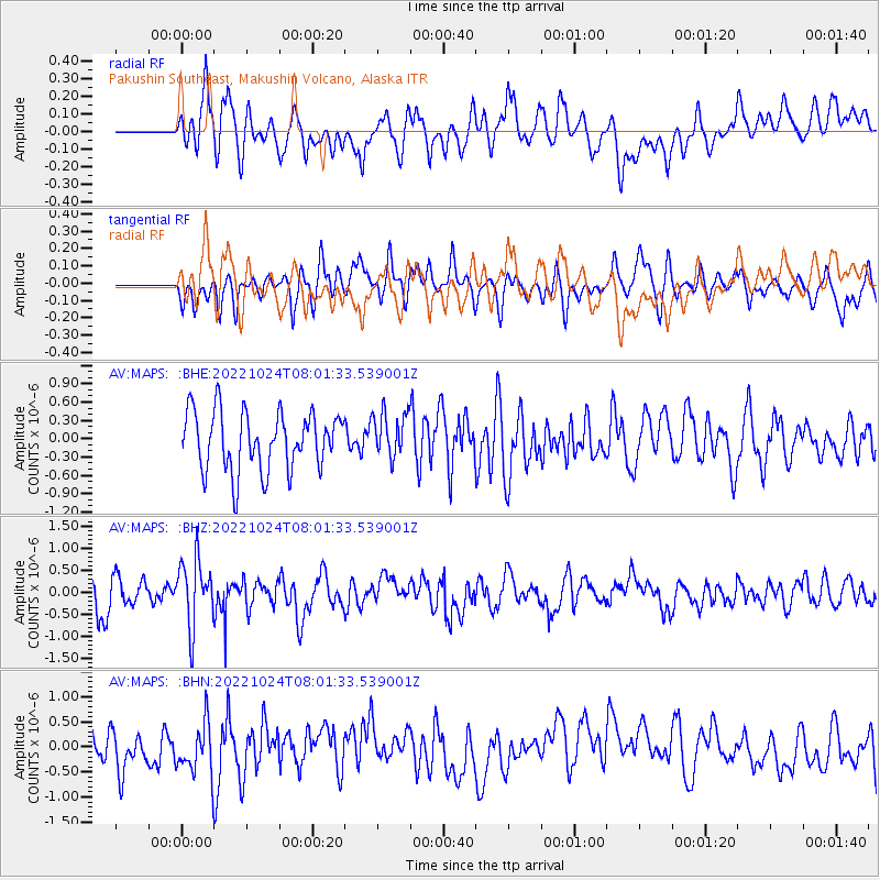
MAPS Pakushin Southeast, Makushin Volcano, Alaska - Earthquake Result Viewer
*The percent match for this event was below the threshold and hence no stack was calculated.
| Earthquake location: |
Tonga Islands |
| Earthquake latitude/longitude: |
-15.5/-173.1 |
| Earthquake time(UTC): |
2022/10/24 (297) 07:51:10 GMT |
| Earthquake Depth: |
114 km |
| Earthquake Magnitude: |
5.9 Mi |
| Earthquake Catalog/Contributor: |
NEIC PDE/pt |
|
| Network: |
AV Alaska Volcano Observatory |
| Station: |
MAPS Pakushin Southeast, Makushin Volcano, Alaska |
| Lat/Lon: |
53.81 N/166.94 W |
| Elevation: |
333 m |
|
| Distance: |
69.2 deg |
| Az: |
3.924 deg |
| Baz: |
186.388 deg |
| Ray Param: |
$rayparam |
*The percent match for this event was below the threshold and hence was not used in the summary stack. |
|
| Radial Match: |
60.930847 % |
| Radial Bump: |
400 |
| Transverse Match: |
39.5232 % |
| Transverse Bump: |
400 |
| SOD ConfigId: |
28764291 |
| Insert Time: |
2022-11-07 07:59:26.214 +0000 |
| GWidth: |
2.5 |
| Max Bumps: |
400 |
| Tol: |
0.001 |
|
Signal To Noise
| Channel | StoN | STA | LTA |
| AV:MAPS: :BHZ:20221024T08:01:33.539001Z | 2.329523 | 7.3780996E-7 | 3.1672147E-7 |
| AV:MAPS: :BHN:20221024T08:01:33.539001Z | 1.3944311 | 5.2875805E-7 | 3.7919267E-7 |
| AV:MAPS: :BHE:20221024T08:01:33.539001Z | 0.7846446 | 3.7458898E-7 | 4.7739957E-7 |
| Arrivals |
| Ps | |
| PpPs | |
| PsPs/PpSs | |


