You are here: Home > Network List > US - United States National Seismic Network Stations List
> Station DGMT Dagmar, Montana, USA > Earthquake Result Viewer
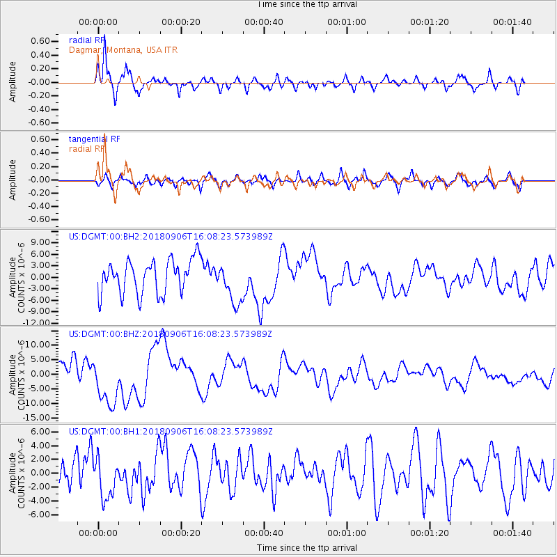
DGMT Dagmar, Montana, USA - Earthquake Result Viewer
*The percent match for this event was below the threshold and hence no stack was calculated.
| Earthquake location: |
Fiji Islands |
| Earthquake latitude/longitude: |
-18.3/179.3 |
| Earthquake time(UTC): |
2018/09/06 (249) 15:56:41 GMT |
| Earthquake Depth: |
657 km |
| Earthquake Magnitude: |
5.7 mb |
| Earthquake Catalog/Contributor: |
NEIC PDE/us |
|
| Network: |
US United States National Seismic Network |
| Station: |
DGMT Dagmar, Montana, USA |
| Lat/Lon: |
48.47 N/104.20 W |
| Elevation: |
0.0 m |
|
| Distance: |
94.9 deg |
| Az: |
40.498 deg |
| Baz: |
248.002 deg |
| Ray Param: |
$rayparam |
*The percent match for this event was below the threshold and hence was not used in the summary stack. |
|
| Radial Match: |
78.83986 % |
| Radial Bump: |
400 |
| Transverse Match: |
50.249672 % |
| Transverse Bump: |
400 |
| SOD ConfigId: |
2963291 |
| Insert Time: |
2018-10-04 15:45:08.146 +0000 |
| GWidth: |
2.5 |
| Max Bumps: |
400 |
| Tol: |
0.001 |
|
Signal To Noise
| Channel | StoN | STA | LTA |
| US:DGMT:00:BHZ:20180906T16:08:23.573989Z | 2.5579796 | 9.099608E-6 | 3.5573419E-6 |
| US:DGMT:00:BH1:20180906T16:08:23.573989Z | 1.2426926 | 2.9743717E-6 | 2.3934895E-6 |
| US:DGMT:00:BH2:20180906T16:08:23.573989Z | 1.2860509 | 5.6452973E-6 | 4.3896375E-6 |
| Arrivals |
| Ps | |
| PpPs | |
| PsPs/PpSs | |


