You are here: Home > Network List > US - United States National Seismic Network Stations List
> Station BOZ Bozeman, Montana, USA > Earthquake Result Viewer
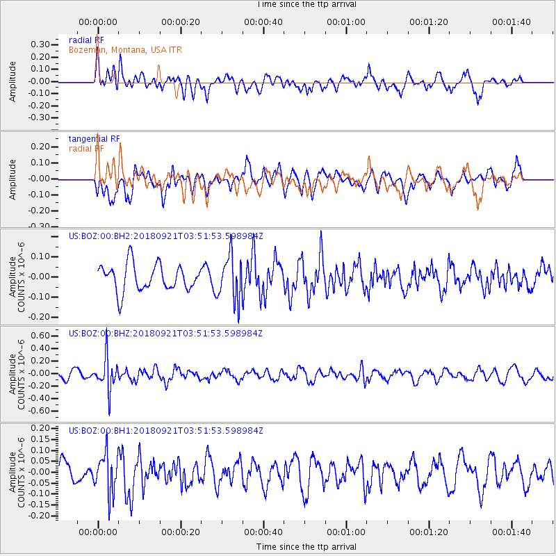
BOZ Bozeman, Montana, USA - Earthquake Result Viewer
*The percent match for this event was below the threshold and hence no stack was calculated.
| Earthquake location: |
Fiji Islands Region |
| Earthquake latitude/longitude: |
-17.9/-179.9 |
| Earthquake time(UTC): |
2018/09/21 (264) 03:40:40 GMT |
| Earthquake Depth: |
653 km |
| Earthquake Magnitude: |
5.9 Mww |
| Earthquake Catalog/Contributor: |
NEIC PDE/us |
|
| Network: |
US United States National Seismic Network |
| Station: |
BOZ Bozeman, Montana, USA |
| Lat/Lon: |
45.65 N/111.63 W |
| Elevation: |
1589 m |
|
| Distance: |
88.3 deg |
| Az: |
40.702 deg |
| Baz: |
242.271 deg |
| Ray Param: |
$rayparam |
*The percent match for this event was below the threshold and hence was not used in the summary stack. |
|
| Radial Match: |
46.995075 % |
| Radial Bump: |
400 |
| Transverse Match: |
46.31254 % |
| Transverse Bump: |
392 |
| SOD ConfigId: |
2963291 |
| Insert Time: |
2018-10-05 03:54:26.669 +0000 |
| GWidth: |
2.5 |
| Max Bumps: |
400 |
| Tol: |
0.001 |
|
Signal To Noise
| Channel | StoN | STA | LTA |
| US:BOZ:00:BHZ:20180921T03:51:53.598984Z | 3.9116197 | 2.6096035E-7 | 6.671414E-8 |
| US:BOZ:00:BH1:20180921T03:51:53.598984Z | 1.5551524 | 9.036398E-8 | 5.810619E-8 |
| US:BOZ:00:BH2:20180921T03:51:53.598984Z | 1.6759546 | 1.09581514E-7 | 6.538454E-8 |
| Arrivals |
| Ps | |
| PpPs | |
| PsPs/PpSs | |


