You are here: Home > Network List > US - United States National Seismic Network Stations List
> Station EGMT Eagleton, Montana, USA > Earthquake Result Viewer
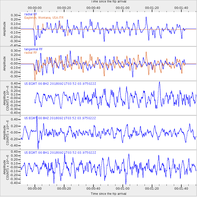
EGMT Eagleton, Montana, USA - Earthquake Result Viewer
*The percent match for this event was below the threshold and hence no stack was calculated.
| Earthquake location: |
Fiji Islands Region |
| Earthquake latitude/longitude: |
-17.9/-179.9 |
| Earthquake time(UTC): |
2018/09/21 (264) 03:40:40 GMT |
| Earthquake Depth: |
653 km |
| Earthquake Magnitude: |
5.9 Mww |
| Earthquake Catalog/Contributor: |
NEIC PDE/us |
|
| Network: |
US United States National Seismic Network |
| Station: |
EGMT Eagleton, Montana, USA |
| Lat/Lon: |
48.02 N/109.75 W |
| Elevation: |
1055 m |
|
| Distance: |
90.6 deg |
| Az: |
39.17 deg |
| Baz: |
243.62 deg |
| Ray Param: |
$rayparam |
*The percent match for this event was below the threshold and hence was not used in the summary stack. |
|
| Radial Match: |
49.20519 % |
| Radial Bump: |
400 |
| Transverse Match: |
37.06425 % |
| Transverse Bump: |
400 |
| SOD ConfigId: |
2963291 |
| Insert Time: |
2018-10-05 03:54:35.821 +0000 |
| GWidth: |
2.5 |
| Max Bumps: |
400 |
| Tol: |
0.001 |
|
Signal To Noise
| Channel | StoN | STA | LTA |
| US:EGMT:00:BHZ:20180921T03:52:03.975022Z | 1.872329 | 2.090575E-7 | 1.116564E-7 |
| US:EGMT:00:BH1:20180921T03:52:03.975022Z | 0.78082806 | 7.581658E-8 | 9.709766E-8 |
| US:EGMT:00:BH2:20180921T03:52:03.975022Z | 1.0609591 | 1.1192592E-7 | 1.0549503E-7 |
| Arrivals |
| Ps | |
| PpPs | |
| PsPs/PpSs | |


