You are here: Home > Network List > US - United States National Seismic Network Stations List
> Station LKWY Lake (Yellowstone--Lake), Wyoming, USA > Earthquake Result Viewer
LKWY Lake (Yellowstone--Lake), Wyoming, USA - Earthquake Result Viewer
*The percent match for this event was below the threshold and hence no stack was calculated.
| Earthquake location: |
Fiji Islands Region |
| Earthquake latitude/longitude: |
-17.9/-179.9 |
| Earthquake time(UTC): |
2018/09/21 (264) 03:40:40 GMT |
| Earthquake Depth: |
653 km |
| Earthquake Magnitude: |
5.9 Mww |
| Earthquake Catalog/Contributor: |
NEIC PDE/us |
|
| Network: |
US United States National Seismic Network |
| Station: |
LKWY Lake (Yellowstone--Lake), Wyoming, USA |
| Lat/Lon: |
44.57 N/110.40 W |
| Elevation: |
2424 m |
|
| Distance: |
88.6 deg |
| Az: |
42.063 deg |
| Baz: |
243.176 deg |
| Ray Param: |
$rayparam |
*The percent match for this event was below the threshold and hence was not used in the summary stack. |
|
| Radial Match: |
52.58197 % |
| Radial Bump: |
400 |
| Transverse Match: |
54.41993 % |
| Transverse Bump: |
400 |
| SOD ConfigId: |
2963291 |
| Insert Time: |
2018-10-05 03:54:50.017 +0000 |
| GWidth: |
2.5 |
| Max Bumps: |
400 |
| Tol: |
0.001 |
|
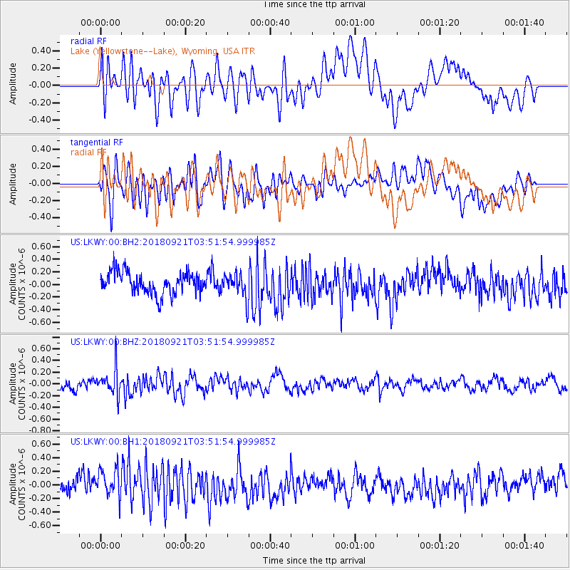
Signal To Noise
| Channel | StoN | STA | LTA |
| US:LKWY:00:BHZ:20180921T03:51:54.999985Z | 2.7282026 | 2.2721301E-7 | 8.328304E-8 |
| US:LKWY:00:BH1:20180921T03:51:54.999985Z | 1.5846546 | 2.0128545E-7 | 1.2702165E-7 |
| US:LKWY:00:BH2:20180921T03:51:54.999985Z | 1.1659288 | 2.0163012E-7 | 1.7293517E-7 |
| Arrivals |
| Ps | |
| PpPs | |
| PsPs/PpSs | |


