You are here: Home > Network List > US - United States National Seismic Network Stations List
> Station MNTX Cornudas Mountains, Texas, USA > Earthquake Result Viewer
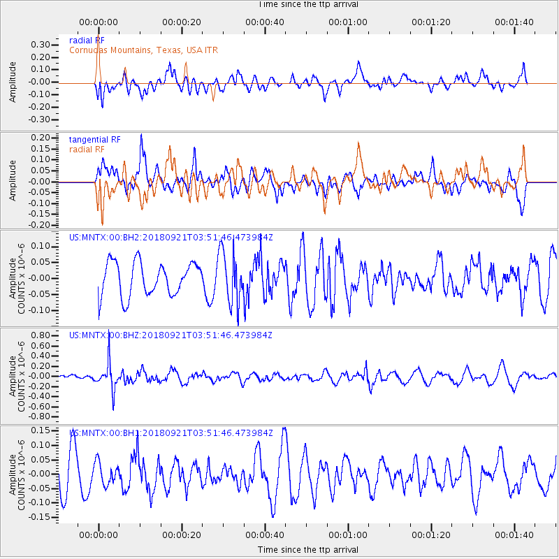
MNTX Cornudas Mountains, Texas, USA - Earthquake Result Viewer
*The percent match for this event was below the threshold and hence no stack was calculated.
| Earthquake location: |
Fiji Islands Region |
| Earthquake latitude/longitude: |
-17.9/-179.9 |
| Earthquake time(UTC): |
2018/09/21 (264) 03:40:40 GMT |
| Earthquake Depth: |
653 km |
| Earthquake Magnitude: |
5.9 Mww |
| Earthquake Catalog/Contributor: |
NEIC PDE/us |
|
| Network: |
US United States National Seismic Network |
| Station: |
MNTX Cornudas Mountains, Texas, USA |
| Lat/Lon: |
31.70 N/105.38 W |
| Elevation: |
404 m |
|
| Distance: |
86.8 deg |
| Az: |
55.382 deg |
| Baz: |
246.819 deg |
| Ray Param: |
$rayparam |
*The percent match for this event was below the threshold and hence was not used in the summary stack. |
|
| Radial Match: |
51.685745 % |
| Radial Bump: |
400 |
| Transverse Match: |
57.585335 % |
| Transverse Bump: |
400 |
| SOD ConfigId: |
2963291 |
| Insert Time: |
2018-10-05 03:54:51.672 +0000 |
| GWidth: |
2.5 |
| Max Bumps: |
400 |
| Tol: |
0.001 |
|
Signal To Noise
| Channel | StoN | STA | LTA |
| US:MNTX:00:BHZ:20180921T03:51:46.473984Z | 4.932441 | 2.6916226E-7 | 5.4569785E-8 |
| US:MNTX:00:BH1:20180921T03:51:46.473984Z | 0.6780545 | 3.8789274E-8 | 5.720672E-8 |
| US:MNTX:00:BH2:20180921T03:51:46.473984Z | 1.5393882 | 8.034819E-8 | 5.219488E-8 |
| Arrivals |
| Ps | |
| PpPs | |
| PsPs/PpSs | |


