You are here: Home > Network List > TA - USArray Transportable Network (new EarthScope stations) Stations List
> Station R26A Arlington, CO, USA > Earthquake Result Viewer
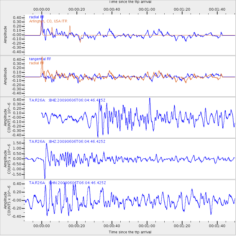
R26A Arlington, CO, USA - Earthquake Result Viewer
*The percent match for this event was below the threshold and hence no stack was calculated.
| Earthquake location: |
Near East Coast Of Honshu, Japan |
| Earthquake latitude/longitude: |
35.5/140.9 |
| Earthquake time(UTC): |
2009/06/06 (157) 05:52:43 GMT |
| Earthquake Depth: |
34 km |
| Earthquake Magnitude: |
5.8 MB, 5.4 MS, 5.8 MW, 5.7 MW |
| Earthquake Catalog/Contributor: |
WHDF/NEIC |
|
| Network: |
TA USArray Transportable Network (new EarthScope stations) |
| Station: |
R26A Arlington, CO, USA |
| Lat/Lon: |
38.30 N/103.45 W |
| Elevation: |
1304 m |
|
| Distance: |
85.5 deg |
| Az: |
45.36 deg |
| Baz: |
312.433 deg |
| Ray Param: |
$rayparam |
*The percent match for this event was below the threshold and hence was not used in the summary stack. |
|
| Radial Match: |
75.37695 % |
| Radial Bump: |
400 |
| Transverse Match: |
77.17975 % |
| Transverse Bump: |
400 |
| SOD ConfigId: |
296552 |
| Insert Time: |
2010-03-29 17:22:21.881 +0000 |
| GWidth: |
2.5 |
| Max Bumps: |
400 |
| Tol: |
0.001 |
|
Signal To Noise
| Channel | StoN | STA | LTA |
| TA:R26A: :BHZ:20090606T06:04:46.425Z | 16.173147 | 7.801586E-7 | 4.8237897E-8 |
| TA:R26A: :BHN:20090606T06:04:46.425Z | 2.751942 | 1.9901965E-7 | 7.2319715E-8 |
| TA:R26A: :BHE:20090606T06:04:46.425Z | 3.4460435 | 2.1103108E-7 | 6.123866E-8 |
| Arrivals |
| Ps | |
| PpPs | |
| PsPs/PpSs | |


