You are here: Home > Network List > TA - USArray Transportable Network (new EarthScope stations) Stations List
> Station N26A Koester Ranch, Padroni, CO, USA > Earthquake Result Viewer
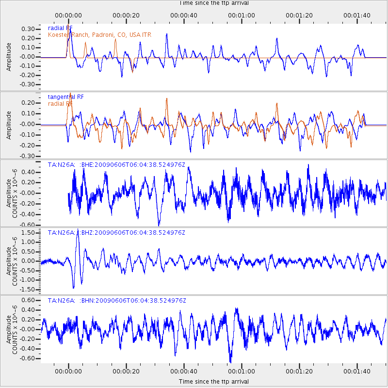
N26A Koester Ranch, Padroni, CO, USA - Earthquake Result Viewer
*The percent match for this event was below the threshold and hence no stack was calculated.
| Earthquake location: |
Near East Coast Of Honshu, Japan |
| Earthquake latitude/longitude: |
35.5/140.9 |
| Earthquake time(UTC): |
2009/06/06 (157) 05:52:43 GMT |
| Earthquake Depth: |
34 km |
| Earthquake Magnitude: |
5.8 MB, 5.4 MS, 5.8 MW, 5.7 MW |
| Earthquake Catalog/Contributor: |
WHDF/NEIC |
|
| Network: |
TA USArray Transportable Network (new EarthScope stations) |
| Station: |
N26A Koester Ranch, Padroni, CO, USA |
| Lat/Lon: |
40.83 N/103.22 W |
| Elevation: |
1284 m |
|
| Distance: |
83.9 deg |
| Az: |
43.37 deg |
| Baz: |
312.392 deg |
| Ray Param: |
$rayparam |
*The percent match for this event was below the threshold and hence was not used in the summary stack. |
|
| Radial Match: |
60.999825 % |
| Radial Bump: |
383 |
| Transverse Match: |
71.555595 % |
| Transverse Bump: |
400 |
| SOD ConfigId: |
296552 |
| Insert Time: |
2010-03-29 17:22:36.012 +0000 |
| GWidth: |
2.5 |
| Max Bumps: |
400 |
| Tol: |
0.001 |
|
Signal To Noise
| Channel | StoN | STA | LTA |
| TA:N26A: :BHZ:20090606T06:04:38.524976Z | 7.2599654 | 8.3966177E-7 | 1.1565644E-7 |
| TA:N26A: :BHN:20090606T06:04:38.524976Z | 1.3267235 | 1.7281408E-7 | 1.302563E-7 |
| TA:N26A: :BHE:20090606T06:04:38.524976Z | 1.5575247 | 2.9239555E-7 | 1.8773093E-7 |
| Arrivals |
| Ps | |
| PpPs | |
| PsPs/PpSs | |


